Geologists Mapping Underground Resources

Pull out a map and you’ll find the Great Lakes area holds resources that no other place can claim. The region is rich in lakes and forests and scenic views. But a road map just covers the surface. We know much less about what’s under the earth. Now, a team of geologists is working to map the resources under the ground. The Great Lakes Radio Consortium’s Erin Toner reports:

Transcript

Pull out a map and you’ll find the Great Lakes area holds resources that no other
place can claim.
The region is rich in lakes and forests and scenic views. But a road map just
covers the surface.
We know much less about what’s under the earth. Now, a team of geologists from the
Great
Lakes states is working to map the resources under the ground. The Great Lakes Radio
Consortium’s Erin Toner reports:


Look outside – look out your car window or into your backyard and try to erase
everything you
see. Take away the playgrounds and the concrete parking lots. Strip away the trees
and the grass
and the topsoil in your garden.


This is the way Kevin Kincare imagines the world. A picture of nothing except naked
landforms
– massive hills and cavernous valleys. All created by gigantic pieces of ice that
gouged and
ground their way down the globe from Canada. This would be the picture of Great
Lakes states
about 15-thousand years ago. It’s the picture Kincare is slowly putting down on paper.


“This is a big chunk of granite and you can see this one side is flat and looks
polished. The
glacier was moving across. There’s grooves right here. So this is the direction
the ice was
moving.”


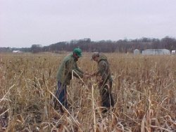
Kincare is a glacial geologist with the Michigan Department of Environmental
Quality. Six years
ago, he helped start the Central Great Lakes Geologic Mapping Coalition. It’s a
group of
geologists from four states – Michigan, Indiana, Illinois and Ohio – and the U.S.
Geological
Survey. They’re working to put together a 3-D digital map of the region’s glacial
geology.
They’ll map everything down to the bedrock, which can be hundreds of feet below the
Earth’s
surface.

The first step in geologic mapping is compiling information from local maps. After
that it’s out
to the field.


At Tacy Brother’s Gravel Pit, a massive machine is sorting big scoops of earth into
piles of sand,
gravel and rocks.


Kincare is now working on mapping a small county on Lake Michigan. He says looking
at a
gravel pit is like looking at nature’s record of thousands of years of changes to
the planet’s
surface.


“That starts to pull the whole story together. How the ice retreated across the
county from east to
west and where all the rivers that were carrying the melting glacier ice and
depositing thick
sections of sand, and where the glacial lakes were, where all the silt and clay was
dropping out.”


Geologists say one of the most important uses for the maps is locating water
resources.
Nationally, Michigan ranks first in the number of people who use household wells to
get their
drinking water. Illinois, Ohio and Indiana rank among the top 15 in the nation for
household
water well use.


Gary Witkowski’s job is to protect the environment in his county in southwest
Michigan. He says
the first step in protecting groundwater is knowing exactly where it is.


“It’d be a tremendous help for us if we could just go to a resource like this and
pull that
information. Not only to us, but, I mean, even to the developer, it would be a
major plus that they
could look at.”


Knowing exactly what’s under the ground also helps planners build in the right
places. And it
helps them avoid building in the wrong places. For example, planners can put
neighborhoods
close to supplies of groundwater. They can discourage development on land rich in
minerals and
construction materials, such as sand and gravel. And they can make sure they don’t
build
industrial plants in places that are especially vulnerable to pollution.


Dennis O’Leary is with the U.S. Geological Survey. He’s helping Kevin Kincare with
the map.


“Those kinds of decisions that involve competing interests really can’t be made
rationally unless
there’s a body of knowledge, of fact, that relates to just what the question’s all
about and that’s
what these maps provide.”


But it could be awhile before people have access to maps this detailed. The four
states in the
mapping coalition and the Geological Survey all have to share 500-thousand dollars a
year for the
project. That means Kevin Kincare can map only one county every three years. It
would take
two centuries just to finish his state.


“We’d have to have a lot of medical breakthroughs for me to finish this project.”


Kincare says the maps are too important to wait that long. He says they need
20-million-dollars a
year from Congress. With that money, they could put together a complete geologic
map of the
Great Lakes region in about 16 years. Kincare says he’s not optimistic they’ll get
that kind of
money.


For the Great Lakes Radio Consortium, I’m Erin Toner.

Beach Closings Continue

Beach closings due to high levels of bacteria are still causing problems in some parts of the region. The Great Lakes Radio Consortium’s Lester Graham reports:

Transcript

Beach closings due to high levels of bacteria are still causing problems in some
parts of the Great
Lakes region. The Great Lakes Radio Consortium’s Lester Graham reports:


Health officials are doing a better job of monitoring many of the beaches around the
Great
Lakes… but that leads to the beaches being closed more often. Each year the Natural
Resources
Defense Council compiles data it gathers from its own sources and from the
Environmental
Protection Agency. Nancy Stoner is with the NRDC. She says the data show not all
beaches are
monitored the same.


“There are comprehensive monitoring programs in Illinois, Indiana, Ohio, and
Pennsylvania and
more limited monitoring programs in Minnesota, Wisconsin, Michigan and New York.
Before
going to the beach, I would encourage people to find out and ensure that that beach
is monitored,
that it’s monitored frequently, and that it’s using criteria that are protective of
public health.”


Stoner says the federal government is not spending enough money to find ways to
reduce or
eliminate the polluted runoff and other sources of bacteria-contaminated water that
cause the
beaches to close.


For the Great Lakes Radio Consortium, this is Lester Graham.

Using Sewage Sludge on Crops

  • Sludge being spread over a field with a manure spreader. (Photo by D. Seliskar, Halophyte Biotechnology Center, Univ. of Delaware)

The more people inhabit the earth – the more sewage there is. Something has to be done with it. Before chemical fertilizers were invented, farmers used human manure to improve their crops. Some still do. About three million dry tons of treated sewage – called sludge – fertilize sod, pasture land and even food crops every year in the United States. The Great Lakes Radio Consortium’s Amy Tardif looks at what the practice may be doing to the environment:

Transcript

The more people inhabit the earth – the more sewage there is. Something has to be done with it.
Before chemical fertilizers were invented, farmers used human manure to improve their crops.
Some still do. About three million dry tons of treated sewage – called sludge – fertilize sod,
pasture land and even food crops every year in the United States. The Great Lakes Radio
Consortium’s Amy Tardif looks at what the practice may be doing to the environment:


The U.S. Environmental Protection Agency says using treated human waste as fertilizer is the
most environmentally sound way to get rid of it. It used to get dumped in the oceans. The
pollution caused dead zones.


Now, using it on land is becoming controversial. As people move closer to rural areas, they
discover what’s happening. It smells. It might also cause damage. Tommy Drymon insists the
creek near his Florida home has changed because farmers near his house use sludge as fertilizer.


“This was the most beautiful place I’ve ever settled down to. And the creek just looks awful now.
It used to be clear and now it’s just black and mucky all the time.”


Drymon says not only has the color changed – there’s more icky residue on the shore. He rarely
sees otters, deer and other wildlife any more. He definitely stopped swimming in it. Drymon and
his neighbors think the human fertilizer nearby farmers use – known as sewage sludge – is to
blame.


Sludge is made at sewage treatment plants. The water people flush down their toilets gets pretty
clean with today’s methods. That means more of what’s leftover stays pretty dirty. It resembles a
thin pudding or a powder depending on how it’s treated. It can contain viruses, bacteria,
chemicals and cancer-causing heavy metals.


“Now this sewage sludge includes not just human waste, it includes Pine Sol if you clean your
toilet bowl with Pine Sol, or if you do oil painting and you flush the paints down the drain or if
you work in a chemistry lab….”


Eric Giroux is an attorney for Earthjustice. He’s handling a lawsuit for Tommy Drymon and his
neighbors. It claims sewage sludge dumped on farms there is wafting through the air making
them sick and running off into the creek.


There are federal, state and county rules meant to prevent runoff. There are buffer zones from
water bodies and rules to protect groundwater. But sludge is not always applied according to the
rules. And there are things missing from the rules – according to The Cornell Waste
Management Institute. They don’t deal with poisons such as flame retardants, the drugs we take
and toxic chemicals that harm fish and wildlife and inhibit plant growth.


But those who use sludge as fertilizer like it.


“It’s a product that has to have something done with it. And if it’s done properly there are no
problems.”


Dennis Carlton has used the free product on his cow pastures for ten years. He says the calves
raised on those pastures end up weighing more than others. Sludge saves him sixty to 160 dollars
an acre on expensive chemicals.


“It’s cost effective and it does a better job than the commercial fertilizer because it last longer
because of the slow release qualities.”


Sludge contains lots of nitrogen – which is food for plants. It’s organic. Plants absorb it very
slowly. And that’s good.


Since 1997, University of Florida Soil scientist Martin Adjei has compared typical commercial
fertilizer – ammonium nitrate – with sludge. He says his studies show the good stuff in sludge gets
into the plants very nicely, and he says plants don’t seem to absorb the heavy metals.


“We measured lead, barium, cadmium, nickel in the plant. They were all point zero, zero two or
something parts per million in the plant.”


That’s lower than the EPA says it has to be. Adjei says only trace amounts of metals sunk into the
groundwater. He doesn’t know yet whether the metals drift into the soil. But he found too much
of the nutrient phosphorous builds up in the soil when fertilized with sludge year after year. He
admits there are many more tests to be done.


This year the EPA responded to complaints about sludge. It plans to test it for 50 chemicals – far
more than ever before. Geff Grubbs is the EPA’s Director of Science and Technology.


“We’re focusing on a couple of things, one is beginning to ramp up some of the research
investments to strengthen our understanding of some of the processes and nature of the
contaminants that could be present in sludge and what risk they might or might not pose. And we
do have a number of things that are in the works both near and longer term that might lead to
changes in the underlying regulations about what can be in biosolids before they are applied to
land.”


And, the EPA and a few industry groups have created a best practices program for willing
utilities. They pledge to control the odor and dust as well as manage the nutrients in their sludge.
The utilities are then audited by impartial, independent, third parties. There are only 48
municipalities participating nationwide.


For the Great Lakes Radio Consortium, I’m Amy Tardif.

Related Links

BIG CLEAN-UP OF RIVER PCBs

There’s a plan in place to clean up a PCB-contaminated river. It could be one of the most comprehensive, and most expensive, river cleanups ever done in North America. The Great Lakes Radio Consortium’s Patty Murray has more:

Transcript

There’s a plan in place to clean up a PCB-contaminated river. It could be one of the most comprehensive, and most expensive, river cleanups ever done in North America. The Great Lakes Radio Consortium’s Patty Murray has more:


The Fox River, which flows into Green
Bay, is the biggest source of PCBs
emptied into Lake Michigan.


Tom Skinner is with the EPA’s Great
Lakes National Program Office. He
says the Fox cleanup will be one of
the most ambitious ever.


“There’s a lot of talk about the
Hudson River project. This project has
the Hudson beat in a number of different ways.”


Such as: the cleanup may cost
400-million dollars, and Skinner says
the amount of contaminants to be
removed is also significant.


“The analogy we’ve used previously is that a
cubic yard is equivalent to a very
compact refrigerator. We’re
going to take probably over 7 million
of those out of the river.”


Seven paper companies that
dumped the PCBs in the river will
pay the cost of the project.


For the Great Lakes Radio Consortium, I’m Patty Murray.

Related Links

Mandated Emission Cuts for Power Plants?

As the U.S. government debates cutting mercury emissions from coal-burning power plants, Wisconsin may become the first state in the region to pass mandatory controls. The Great Lakes Radio Consortium’s Chuck Quirmbach reports:

Transcript

As the U.S. government debates cutting mercury emissions from
coal-burning power plants, Wisconsin may become the first state in the
region to pass
mandatory controls. The Great Lakes Radio Consortium’s Chuck Quirmbach
reports:

Mercury released by the burning of coal often falls
into bodies of water and can be passed up through the food chain.
A proposal going before the Wisconsin Natural Resources
Board would order big Wisconsin utilities to cut mercury
emissions 40% by 2010 and 80% by 2015.


Environmentalists want faster
and deeper reductions.
Lloyd Eagan is a Wisconsin air management official. She says
her agency is taking a cautious approach
to how utilities would meet their goal.


“We did not assume that there would be improvements in
mercury control technology… which there will be, but we
based the rule on what is in existence today that we
think will work.”

Utilities still say the Wisconsin mercury plan goes too far.
They want the state to wait until approval of a federal cleanup plan.
That plan targets several different air pollutants.


For the Great Lakes Radio Consortium, I’m Chuck
Quirmbach in Milwaukee.

Study: Homebuyers Prefer Clearer Lakes

According to a new study, property next to a clear lake is worth more than property next to a murkier lake. The Great Lakes Radio Consortium’s Christina Shockley has more:

Transcript

According to a new study, property next to a clear lake is worth
more than property next to a murkier lake. The Great Lakes Radio Consortium’s Christina Shockley
reports:


Researchers from Bemidji State University looked at 37 lakes in upper
Minnesota. They collected sale prices on homes, and compared them to
pre-existing water clarity levels. Patrick Welle is a professor of
Economics and Environmental Studies at Bemidji State. He co-authored the
study.


“So we ran the model not only over the twelve hundred and five sales, but
we also ran it by the six different regions separately, and in each case water
quality is one of the most significant predictors of the sale price of the lakeshore
property.”


So, the clearer the lake water, the higher the property value. Researchers say
landscaping, clearing vegetation up to the shore, and fertilizing can decrease
water clarity. They say a manicured lawn can boost property value right away,
but in the long run, it could be a detriment.


For the Great Lakes Radio Consortium, I’m Christina Shockley.

States Work to Plug Abandoned Wells

When abandoned wells aren’t sealed properly, they can pollute the water below. A number of states across the region are working to solve the problem. The Great Lakes Radio Consortium’s Erika Johnson has more:

Transcript

When abandoned wells aren’t sealed properly, they can pollute the water below. And in some of
these wells, children and animals have gotten trapped. A number of states across the region are
working to solve the problem. The Great Lakes Radio Consortium’s Erika Johnson has more:


All states across the region have certain regulations for plugging abandoned wells. But not all
states have specialized programs to address the problem.


Programs to cap abandoned wells have existed in Minnesota and Wisconsin for decades. Now,
other states are developing their own programs.


Officials in Michigan face a particular challenge because more of these wells exist there than in
any other state in the country – close to 2-million by some estimates.


Jim McEwan is with the Michigan Department of Environmental Quality. He says surface
pollutants can be channeled down into unplugged wells:


“The contaminants can gain access by penetrating the corroded well casing because many of them
have been in the ground for 70 to 100 years, or so, and then going right down, like a drain, into
the lower drinking water aquifers.”


So far, Michigan, Minnesota and Wisconsin each plug about 10-to-20-thousand wells per year.


It generally takes several hours and costs a few hundred dollars to seal each well. And
homeowners have to pay for the sealing of any unused wells on their property. But some states
do offer financial assistance.


For the Great Lakes Radio Consortium, I’m Erika Johnson.

States Tackle Wetlands Protection

In response to a 2001 Supreme Court ruling, the Environmental Protection Agency and the Army Corps of Engineers say they will remove Federal Clean Water Act protection for small wetlands that are considered “isolated” from larger waterways. That leaves it up to the states to decide whether or not to protect them. The Great Lakes Radio Consortium’s Corie Wright has more:

Transcript

In response to a 2001 Supreme Court ruling, the Environmental Protection Agency and the Army Corps of Engineers say they will remove Federal Clean Water Act protection for small wetlands that are considered “isolated” from larger waterways. That leaves it up to the states to decide whether or not to protect them. The Great Lakes Radio Consortium’s Corie Wright has more:


Environmentalists say small, isolated wetlands are crucial to local ecosystems. They filter soil
pollutants, prevent erosion, and provide a habitat for fish and wildlife. But the Bush
administration’s plan to redefine wetlands protection could leave twenty percent of the nation’s
wetlands unguarded.


Critics say the move would benefit homebuilders and other developers, who have long
complained that federal agencies have over-extended the Clean Water Act.


Julie Sibbing is a wetlands policy specialist with the National Wildlife Federation. She says if
states try to protect these wetlands themselves, they’ll meet opposition from the same interests
that lobbied to limit federal wetlands protection.


“Even if state wetlands were protected all along for the last 30 years under the Clean Water Act, it’s still
very politically difficult for states to change their own laws – that will bring a lot of opponents of
regulation out of the woodwork.”


Despite those difficulties, legislators in Illinois, Indiana, Wisconsin, Ohio, and Minnesota have all
pushed for tighter wetlands protection. So far, Wisconsin is the only Great Lakes state to pass a
bill protecting areas no longer covered by the Clean Water Act.


Michigan is one Great Lakes state in the process of trying to preserve wetlands that fall through
the regulatory gap. Under Michigan law, isolated wetlands smaller than five acres don’t qualify for state
protection.


State Senator Paul Condino is championing a bill to preserve those areas. He says it’s
up to the state to protect Michigan’s public wetlands.


“I don’t think President Bush and the folks in office on the federal level have any sense that
they’re going to go out to create further safeguards. Michigan has lost an estimated 5.5 million acres
of wetlands, or almost 50% of its original wetland heritage. That’s significant.”


But the National Wildlife Federation’s Julie Sibbing says it will be an uphill battle for any state to
pass regulation.


“They’re being left with pretty large gaping holes in their own state water quality statutes, and at
a time that couldn’t be worse. Many state governments are really reeling from budget deficits, so
right now is just a really hard time for them to step into that breach.”


Sibbing says her group is pushing for a congressional bill that would slightly modify the Clean
Water Act so the EPA can once again protect smaller isolated waterways.


But she says the bill is certain to meet stiff opposition from House Republicans. Sibbing says if
the bill doesn’t pass, it’s unlikely states can shoulder wetlands protection on their own.


And that means that small, isolated wetlands could be left out to dry.


For the Great Lakes Radio Consortium, I’m Corie Wright.

Farm Buffer Strips a Lasting Solution?

  • Tom Miller's farm in Central Illinois includes buffer strips that provide habitat and food for wildlife and keep chemicals and soil out of a nearby river. Photo by Jonathan Ahl.

Each spring, the seasonal rains and melting snow lead to millions of gallons of water entering rivers and streams around the Midwest. While that water is important for the rivers’ health, it brings with it soil, herbicides, and insecticides from farms. Programs designed to help keep soil and chemicals on the farm and out of the watershed are growing in popularity around the region. The Great Lakes Radio Consortium’s Jonathan Ahl has more:

Transcript

Each spring, the seasonal rains and melting snow lead to millions of gallons of water entering
rivers and streams around the Midwest. While that water is important for the rivers’ health, it
brings with it soil, herbicides, and insecticides from farms. Programs designed to help keep soil
and chemicals on the farm and out of the watershed are growing in popularity around region. The
Great Lakes Radio Consortium’s Jonathan Ahl reports:


It’s a cold Spring day on Tom Springer’s Farm. But the strong winds and light rain do not
dampen the spirit of Springer. He’s showing off strips of land that contain tall grasses that would
normally be farmland waiting for the Spring planting:


“What we’re doing, we’re trying to create shelter belts up against these food plots for the birds
and the wildlife to have shelter in the winter.”


Springer is referring to buffer strips. The long, narrow pieces of land that take up about one acre for
every 30 acres of this farm in Central Illinois. The strips provide food and habitat for wildlife
such as quail and pheasants. They also provide a “catch” for some of the soil and chemicals that
would otherwise end up in the nearby Mackinaw River. That’s why some groups call them filter
strips. Springer is taking part in several state and federal programs that pay him to take the land
out of production and convert it to these buffer strips. Springer says he likes having the wildlife
around and wants to help the environment. But he says the financial incentives are the essential
ingredient that makes his buffer strips a reality:


“It was getting to the point that us small-time farmers we’re going to get pushed out because of
the economics of it. So I went ahead and did this, and it’s really worked out good. It’s a different
way of farming. It really is. What I’m doing, I’m farming the wildlife. I’m farming the
conservation program.”


Depressed crop prices and growing expenses are making the buffers strips a more popular
alternative for farmers. Adding to the financial advantage are not for profit groups such as Trees
Forever and Pheasants Forever. They make contributions of time, materials, and expertise to
farmers like Springer. That makes it easier to build the strips that comply with the state and
federal subsidy programs.


Tom Miller is with Trees Forever. He says the government payments get farmers to consider the
program. But he says they stay in because they know what they’re doing is right for the
environment. Miller says farmers are learning the dangers of plowing their land right up to the
banks of rivers and streams:


“Typically in the past, it’s been whatever farmland was there they would farm up to the edge.
But I think increased awareness and education over the last ten years from local and state
agencies and non-profits helped farmers realize you can’t do that.”


Miller says his group’s Buffer Initiative and others around the Midwest are gaining momentum
and making a difference in cutting down on pollution in waterways. But not everyone believes
these buffer strips are the magic bullet to fight erosion and chemicals in the watershed:


“I would say they are necessary but they’re not sufficient.”


Terry Kohlbuss is the director of the Tri-County Regional Planning Commission, a central Illinois
governmental group that has pushed for numerous water clean-up programs. He says buffer
initiatives are good programs. But he says it is only a drop in the bucket in the fight to help
bodies of water:


“But the other important source of that accelerated flow of water through the natural drainage
system is from developed areas. The solution set here is that there are probably 15 to 20 or 30
different types of programs that need to be in place to really get after this problem successfully.”


Kohlbuss says land management plans that cover all types of land will be necessary if there is
ever going to be meaningful progress in keeping soil and chemicals out of the rivers. Other
critics of the Buffer Strip program say there’s no guarantee the program will last because farmers
are reacting to the subsidies. Tom Springer says he has heard the criticism that if crop prices go
up or the payments run out, farmers will give up on conservation programs:


“I think a lot of them, if the program burns out in fifteen years, they’re talking about tearing a lot
of these out. We’ll I’m not, I’m going to leave mine in. They are on sand hills that were always
burnt up in the fall, you know. Most of the time it wouldn’t make much of a crop anyway, so we
are going to use it for conservation measures.”


Organizers of the buffer strip programs hope all of their participants will have the same point of
view as Tom Springer. Meanwhile, they continue working on finding more farmers to sign up for
the program.


For the Great Lakes Radio Consortium, I’m Jonathan Ahl.

Ice-Breakers Finish Up Duty

  • The Coast Guard cutter Sundew was built in 1944 in Duluth as a "buoy tender." In 1979, the Coast Guard had the ship's hull reinforced and beefed up its engine so the ship could double as an icebreaker. Photo by Chris Julin.

Cargo ships are moving on the Great Lakes, but Coast Guard icebreakers are still on duty on the north side of the Lakes. The Coast Guard’s massive icebreaker, the “Mackinaw,” smashed ice from its home in Michigan all the way across Lake Superior to Duluth. And the Coast Guard cutter “Sundew” has been chipping away at the ice in Duluth for weeks. The Great Lakes Radio Consortium’s Chris Julin has this report:

Transcript

Cargo ships are moving on the Great Lakes, but Coast Guard icebreakers are still on duty on the
north side of the Lakes. The Coast Guard’s massive icebreaker, the “Mackinaw,” smashed ice
from its home in Michigan all the way across Lake Superior to Duluth. And the Coast Guard
cutter “Sundew” has been chipping away at the ice in Duluth for weeks. The Great Lakes Radio
Consortium’s Chris Julin has this report:


There’s a whiff of spring in the air in lots of places, but parts of Lake Superior are still covered
with ice. Cargo ships are leaving their berths where they spent the winter. But when the first
ships got ready to go, the ice on the Duluth Harbor was still two feet thick. That’s thick enough to
keep a ship locked in place.


The Coast Guard cutter Sundew carved a path through the ice so ships could leave.


(sound of chop, splash)


As the Sundew churns away, slabs of ice tip on edge under the bow. Each slab looks like the
floor of a single-car garage turned on edge. The Sundew will cut a swath several miles long, and
then come back along the same path. With each pass, the shipping lane gets a little bit wider.


Bev Havlik is the commanding officer on the Sundew.


“We’re taking out just little shaved bits of it at a time to make the ice chunks smaller. It’s like
sawing a log, just shaving off a bit of it at a time.”


“The Sundew wasn’t built as an icebreaker. It’s usual duty is tending buoys. The ship places, and
maintains about 200 navigational buoys on Lake Superior. But a couple decades ago, the Sundew
got some extra steel added to its hull, and a new, bigger engine. Since then, it’s done double duty
as an icebreaker.”


Commander Bev Havlik says the Sundew slices through thin ice like a butter knife. But in
thicker ice, like this stuff, the hull actually rides up on top of the ice and pushes down through it.
That’s why there are three mini-van-sized chunks of concrete on the ship’s deck. Each one weighs
12,000 pounds.
“It helps us bite into it with the bow, instead of riding up too high.” It keeps the weight down
forward more.”


A little bit like putting sandbags in the back of your pickup in the wintertime?


“It’s a similar sort of principle, right. It gives you the bite you need.”


Icebreaking is serious business. It gets ship traffic moving weeks before the ice melts. But
beyond that, Bev Havlik says it’s really fun.


“This is awesome. It’s the only job that I’d ever had where they pay us to come out and break
something.”


The Sundew is 180 feet long. That’s about the length of 10 canoes lined up end to end. It has
about 50 crew members. One of the junior crew members is usually at the wheel. The real
“driver” is an officer who’s standing 20 feet away, out on the deck through an open door. The
officer adjusts the ship’s speed, and calls out a steady stream of steering commands to the
“helmsman” — that’s the guy at the wheel.


(sound of Helsman)


“Right five-degrees rudder … steady as she goes, aye.”


Ensign Jason Frank is about to take his turn driving the Sundew. He wears a big rabbit fur hat
when he’s out on the deck driving the ship.


“We actually have face masks and goggles for when it really gets cold. It gets so cold out here
sometimes it feels like your eyes are going to freeze out, or something.”


(natural sound)


Jason Frank is halfway through his two-year stint on the Sundew. Then he’ll be stationed
somewhere else, and the Sundew will be removed from service. The ship was built in Duluth in
1944, and it’s retiring next year. Jason Frank wanted to work on the Sundew because aren’t many
ships like this still in service. On newer vessels, the officer driving the ship stands inside. And
here’s something right out of the movies – the Sundew has a big, brass steering wheel.


“Whereas with the new ships, most the new ships have just a little joystick. It’s very similar to
like a joystick you’d have maybe when you’re playing a computer game or something. All you
have to do is turn that joystick and the computer tells the rudder what to do. We’re actually
maneuvering the throttles, we’re actually driving. With the new ship, basically it has an
autopilot.”


The ice is melting in the Duluth Harbor, but it still clumps together on windy days and makes
trouble for ships. The Coast Guard cutter Sundew will stay on ice-breaking duty until the
weather warms up, and a good southwest wind pushes the rest of the ice out of the harbor into
Lake Superior.


For the Great Lakes Radio Consortium, this is Chris Julin.


(sound fade)