Mapping Underground Rivers

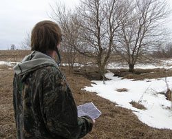
  • DNR hydrologist Jeff Green consults a high-resolution topographic map to figure out which sinkhole is ahead of him. The trees and grass that grow up around the sinkhole form a buffer, allowing water to soak into the soil and filtering any pollutants before it reaches the aquifer.(Photo courtesy of Stephanie Hemphill)

Spring in the north is a time of melting snow and running water. It’s the best time of year for people who study underground water flows. Those underground rivers are important, especially where surface water easily drains into bedrock. It can quickly carry pollution long distances. Hydrologists try to map these underground rivers to help protect fragile ecosystems. As Stephanie Hemphill reports, the first step in making these maps is a process called dye tracing.

Transcript

Spring in the north is a time of melting snow and running water. It’s the best time of year for people who study underground water flows. Those underground rivers are important, especially where surface water easily drains into bedrock. It can quickly carry pollution long distances. Hydrologists try to map these underground rivers to help protect fragile ecosystems. As Stephanie Hemphill reports, the first step in making these maps is a process called dye tracing.

When the snow is melting in the woods and fields, Jeff Green wants to know where it’s going.

“We’re going to hike back to two springs.”

Green is a hydrologist with the Minnesota Department of Natural Resources, and an expert in the limestone geology of Southeast Minnesota.

Green climbs a fence and splashes through a stream that’s flooding a pasture. The stream is bordered by a natural wall of limestone.

Melting snow seeps into the limestone. It runs down vertical cracks to bigger horizontal openings that look like miniature caves. Jeff Green calls these “conduits,” and some are three inches wide.

“You can imagine a pipe that big — water would move very fast, like we’re seeing. So these conduits are what we’re dye tracing.”

Green has traipsed out to this pasture to put what he calls a “bug” in a spring. The ‘bug’ is a small mesh bag about the size of a cellphone, packed with charcoal. The charcoal will capture a dye that he’ll pour into melting snow in a sinkhole a few miles away. He’ll do this in several different spots.

By tracing the paths of different colors of dye, he’ll learn the sources of the water that feeds each spring. That will help him make what he calls a springshed map.

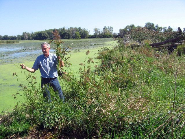
We slog across a corn field that’s dotted with small groves of trees. They’re growing around miniature canyons, about 20 feet deep. Here, you can see how this honeycombed water highway works, and this is where Jeff Green will pour the first dye.

“This is a place where there was a conduit, an opening in the limestone.”

Green climbs down carefully into the crevasse.

“Listen! … All right!”

He’s found some running water.

“Water’s running right here. I don’t know where it’s going but it’s going someplace. So I’m going to try pouring dye here.”

He pours a cup or so of a bright red fluorescent dye into the snow.

Green marks the spot with a GPS unit. This is a place where surface water and groundwater meet.

“That snow-melt is surface water, it’s going into this sinkhole and it’s becoming groundwater as you’re listening to it.”

That means what happens here on the land directly affects the quality of the groundwater.

“In this case, it’s pretty good, you’ve got conservation tillage, lots of corn stalks left to keep the soil from eroding, and then you’ve got grass, permanent cover, around the sinkholes. So this is actually really good.”

There are wonderful trout streams around here. The map Green is making will help protect those streams by pinpointing the source of the water that feeds them.

In a day or two, Green will check the “bugs” he put in the springs, and find out exactly where the dye from this sinkhole went.

He usually finds water traveling one-to-three miles underground before it surfaces.

When the springshed map is finished, he’ll share it with local governments, farmers, and people who want to protect the water in this landscape.

For The Environment Report, I’m Stephanie Hemphill.

Related Links

Online Map of Wildlife Diseases

  • Dr. Robert McLean works on a West Nile disease project at the National WIldlife Health Center with a Carolina Chickadee (Photo courtesy of the US Fish and Wildlife Service)

There’s a new online map for tracking
wildlife diseases that threaten animals and
people. Chuck Quirmbach reports:

Transcript

There’s a new online map for tracking
wildlife diseases that threaten animals and
people. Chuck Quirmbach reports:

Diseases such as West Nile Virus, Chronic Wasting Disease, Avian Flu, and
others are now often in the news. A website partly developed by the US
Geological Survey aims to track reports of the disease outbreaks around the
world.

Veterinarian Josh Dein leads the project. He says he hopes both health care
professionals and the general public use the online map.

“One of the things you can do is say ‘what’s happening in my neighborhood,
what’s happening in my state, my country?’ And maybe I’m traveling to
someplace else. Maybe I want to look to see what’s happening somewhere else.”

Dein says the map also allows people to narrow their search to specific countries, types of
disease and affected species.

For The Environment Report, I’m Chuck Quirmbach.

Related Links

Ten Threats: Saving Wetland Remnants

  • Winous Point Marsh Conservancy and Duck Hunting Club's Roy Kroll collects millet. (Photo by Julie Grant)

Among the Ten Threats to the Great Lakes is the loss of thousands of square miles of wetlands along the lakes. From Superior to Ontario and on up the St. Lawrence Seaway, we’ve lost some of the most important wildlife habitat along the edges of the lakes. For example, 200 years ago, much of the southern shore of Lake Erie was a huge swamp. Most of those wetlands have been drained and filled since European settlement. Julie Grant reports on efforts to maintain the little bit that remains:

Transcript

In our next report in the series, Ten Threats to the Great Lakes, we’re going to hear about changes to a large area that drains into the lakes. Our guide through the series is the Great Lakes Radio Consortium’s Lester Graham:


Among the Ten Threats to the Great Lakes is the loss of thousands of square miles of wetlands along the lakes. From Superior to Ontario and on up the St. Lawrence Seaway, we’ve lost some of the most important wildlife habitat along the edges of the lakes. For example, 200 years ago, much of the southern shore of Lake Erie was a huge swamp. Most of those wetlands have been drained and filled since European settlement. Julie Grant reports on efforts to maintain the little bit that remains:


Researchers from the Cleveland area park district have been driving hours to get here to this bit of swamp nearly every day since last spring. Biologist Rick Spence and his partner wade through two feet of boot-sucking mud. They’re looking for turtles. Blanding’s turtles, to be exact. With a distinctive bright yellow chin and throat, it’s designated as a ‘species of special concern’ in Ohio…


“The Blanding’s originally were found in this area in the southern portion of Lake Erie, along this basin area. And so there’s a lot of the Blanding’s in here. It doesn’t get any better than this. We have nothing like this really around the Cleveland area that I know of.”


This area is the 150 year-old Winous Point Marsh Conservancy and Duck Hunting Club. It’s the largest privately owned coastal wetland in Ohio. It’s a thin strip of marsh that runs eight and a half miles along the shore.


Roy Kroll has been Executive Director of the Duck Hunting Club for more than twenty years. He keeps busy balancing the needs of researchers, biology classes, and reporters.


Kroll takes me onto the marsh in a wooden boat. He uses an old-fashioned pole to push us through water that’s only a couple of inches deep. It’s slow and quiet. He stops and uses the pole to slap the water for a call and response with migratory birds. (slap) He can hear who’s hiding in the cattails, arrowhead, and other emergent wetland plants…


(Kroll slaps water twice, birds respond)


“Well, looks like the teal have left and the rail are here.”


Kroll says the 4,500 acre marsh harbors over 100,000 waterfowl, mostly ducks, during November’s peak migration. There aren’t many places like this left on the Lake Erie coastline. More than 90 percent of the region’s wetlands have been drained. Most of that was done in the mid-1800s.


The area was once known as the Great Black Swamp. It stretched from Lake Erie all the way to Indiana. Much of it was under a dense canopy of hardwood trees. Kroll says it was a great system to filter river waters entering the lake. But European settlers and land speculators cut down most of the trees, dug ditches and straightened stream channels to move water quickly off the land. They built roads and transformed the swamp into rich, productive farm fields.


“You have to put yourself in the time period. Rightfully so, that was considered progress. And now we have to look back and say, well, yeah, it was progress and now it looks like it’s not progress. And if we’re not going to eliminate all these wetlands, we’re going to have to take some proactive measures to do it.”


Even at Winous Point, some of the wetlands are in poor condition. Standing on a man-made dike we look one way and see all kinds of plants: cattails, duckweed, and lily pads. But look to the side that’s not protected by the dike, and there’s no vegetation. Hand-drawn maps from the 1800s show a diversity of plants here, but now it looks like an open bay…


“What we’re looking at now is an open water wetland. And again, with no plants, we don’t have the structure for fish, invertebrates, and even plankton and algae to colonize on plant stems. It’s nowhere near as productive.”


Kroll says it’s not nearly as productive as the protected area. He says high lake levels, invasive carp, and pollution running off the land and into the rivers that drain into the lake have all made it tough for marsh vegetation to survive. Without plants, Kroll says the wetland can’t clean water running off the land…into the lake. He says it’s unrealistic to expect a short band of remnant wetlands to do the job of a hundreds of square miles of swamp forest.


“The key is to start at the upstream far upstream head of the watershed and begin restoring wetlands from there down to here.”


There are some efforts to re-store small parts of the Great Black Swamp. But Kroll says it’s also important to protect the little bit of the original coastal wetlands that are still left.


For the GLRC, I’m Julie Grant.

Related Links

Farming With Computers

You probably have a computer in your car, on your desk and maybe even in your stove. It seems like there are computers everywhere these days helping with everything from our checking accounts to our turkey roasts. Now researchers want to install computers in another place, where most of us would least expect it – in Old MacDonald’s tractor. The Great Lakes Radio Consortium’s Daniel Grossman has this story: