Paying for Ponds to Stem Farm Runoff

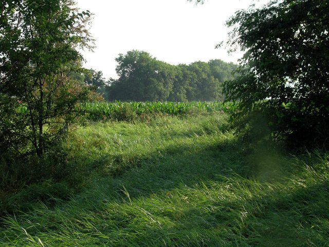
  • Alan Roberson's pond traps sediment. Before the pond was built, silt washed into a creek and caused problems farther downstream. (Photo by Lester Graham)

Since the dust bowl days of the 1930s Depression, the government has been working with farmers to reduce erosion. Today, soil conservation is better. But fields still lose a lot of topsoil because not all farmers use the best conservation methods. Dirt is washed away by rain. That silt clogs up streams, rivers and lakes. But one region is trying to intercept the silt before it gets to the river system. The GLRC’s Lester Graham reports:

Transcript

Since the dust bowl days of the 1930s Depression, the government has been working with
farmers to reduce erosion. Today, soil conservation is better. But fields still lose a lot of
topsoil because not all farmers use the best conservation methods. Dirt is washed away
by rain. That silt clogs up streams, rivers and lakes. But one region is trying to intercept
the silt before it gets to the river system. The GLRC’s Lester Graham reports:


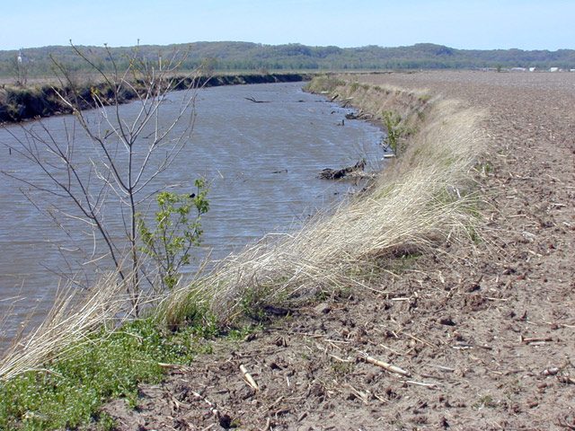
Farm fields in all or part of 38 states drain into the Mississippi River. Some of the
tributaries of the Mississippi are so silted that dredges have to operate around the clock to keep river
shipping lanes open.


The Sangamon River in central Illinois is not big enough for shipping cargo, but it does
run into the man-made Decatur Lake. The city of Decatur gets its water from that lake
and often has to dredge it to keep the water inlets from clogging up.


Keith Alexander is the Director of Water Management for the city of Decatur, Illinois.
He says a little soil erosion on enough farms adds up:


“And the drainage area that runs into the lake is 925 square miles of some of the world’s
best topsoil. We have literally a half-a-million acres of corn and soybean fields that flow
into our lake that we use for drinking water purposes.”


Not only does the silt clog the lake, it also carries fertilizers and pesticides with it,
polluting the lake. The city has offered farmers financial incentives to reduce soil
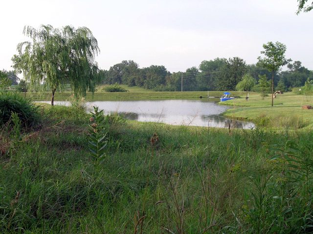
erosion. But it hasn’t gotten enough participation from farmers to solve the problem. So,
the City of Decatur decided to try another approach. They would offer money to landowners to build ponds. Those ponds would be located in key drainage areas next
to farm fields.


Shannon Allen is a watershed specialist with the Macon County Soil and Water
Conservation District. He says it turned out to be a pretty popular program:


“The landowners wanted it for recreational purposes, obviously fish, maybe swimming
or whatever. We’re putting them in so we can collect sediment from the farm fields
above them so they don’t go into the river system.”


Shannon Allen says the ponds work a lot better at keeping silt out of creeks and rivers and lakes
than other methods to reduce erosion.


“Basically ponds collect 90% of the silt. And, so anytime you can put up a pond, you’re
doing better than a grassed waterway or a terrace that don’t reduce sediment loads by that
much.”


The city offers up to 5,000 dollars to landowners, but that’s well short of the actual cost. A typical pond
can cost 20 to 25,000 dollars to build. But landowners have been taking the city’s offer.


Alan Roberson owns a few acres at the bottom of a sloping corn field. About 42 acres
drains onto his property and then into a creek. He says when he moved there, there was
just a big ditch where stormwater from the neighboring farm fields washed a bigger and
bigger gully, carrying sediment to the creek:


“There was places eight, ten feet deep. We’ve lived here almost 20 years and it just kept
getting deeper as it went along. I hated to even come down here and look at it because it
was getting so bad. So, I’m glad that program came along to take care of it. As you can
see, it’s not doing that anymore.”


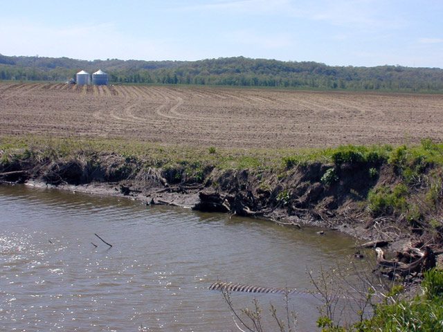
Roberson took advantage of the city’s pond program. Where the gully used to be, a carpet
of green lawn now borders a picturesque little pond.


Alan Roberson says the pond has a pipe in the bottom of it, kind of like a bathtub plug. It
was part of the design required to get the matching funds from the city. When the pond
fills up with silt, Roberson will be able to drain it and dig out the soil:


(Sound of water trickling)


“See this valve down here? You can actually pull that up. It could very well be 20 years
from now they’ll get enough silt in here where a person will have to bring it down. But
like I said, it’s designed to do that.”


That silt is some of the richest dirt in the corn belt and could be sold back to farmers or
used for gardens or flower beds. The landowner will have to pay the cost of digging it
out, but it’s that much more silt that won’t have to be dredged from the lakes or the rivers
that feed them, where people get their public water supply.


For the GLRC, this is Lester Graham.

Related Links

Supreme Court to Hear Landmark Wetlands Case

  • The U.S. Supreme Court is hearing a case that will determine how much power the federal government has over isolated wetlands - wetlands that aren't adjacent to lakes or streams. (Photo by Lester Graham)

On Tuesday, the U.S. Supreme Court will hear arguments that could decide which wetlands the federal government can regulate. The case before the court involves a couple of construction projects in the state of Michigan, but it’s being followed closely throughout the country. The Great Lakes Radio Consortium’s Michael Leland has more:

Transcript

On Tuesday, the U.S. Supreme Court will hear arguments that could
decide which wetlands the federal government can regulate. The case
before the court involves a couple of construction projects in the state of
Michigan, but it’s being followed closely throughout the country. The
Great Lakes Radio Consortium’s Michael Leland has more:


The federal Clean Water Act is supposed to stop people from polluting
streams, wetlands and other waterways that are connected to the
country’s major lakes, rivers and coastal areas, but what if the wetland in
question is located 20-miles from the nearest major waterway? Is it
covered by the Clean Water Act? That’s the question the court will
consider.


In the 1980’s John Rapanos started moving sand from one part of
property he owned in Michigan to another, to fill in some wetlands. He
wanted to sell the land to a shopping mall developer. Trouble is, he
didn’t get permits from the Army Corps of Engineers to fill in the
wetlands. The government says he should have.


“The property has a drainage ditch that runs through it…”


Robin Rivett is a lawyer for the Pacific Legal Foundation. It’s a
property-rights group that is representing Rapanos.


“And because of the movement of the sand on the property, which is
characterized as wetlands, the government came in and has prosecuted
him for actually discharging fill material into the navigable waters.”


Rapanos was charged with violating the Clean Water Act. Washington is
demanding 13-million dollars in fines and fees, and wants him to set
aside about 80-acres as wetlands.


In another case, that’s been combined with the Rapanos matter,
developers in Southeast Michigan were denied permits to fill in wetlands
so they could build a condominium complex. That site is about two
miles from Lake St. Clair, which lies between lakes Huron and Erie.


In both cases, the federal government says the sites fall under the Clean
Water Act because they’re located near navigable waters. Actually, that
term – navigable waters – has evolved over the years and come to mean
“interstate or intrastate waters,” along with their wetlands and tributaries.


The plaintiffs, their attorneys and supporters say the land should be
governed by state environmental regulations, rather than the federal
Clean Water Act, but on the side of the government in this case is 35
state governments, along with many environmental and conservation
groups.


Jim Murphy is a lawyer for the National Wildlife Federation. His group
has filed briefs on behalf of more than a dozen organizations that support
the federal position.


“What is at stake here is the ability of the act to protect the vast number
of tributaries that flow into navigable waters and the wetlands that
surround and feed into those tributaries. If those tributaries and wetlands
aren’t protected under the federal Clean Water Act, it becomes difficult if not
impossible under the Clean Water Act to achieve its goal to protect water
quality.”


Murphy says if the Supreme Court rules that Congress did not intend to
protect wetlands like the ones in this case, then about half the wetlands in
the country could lose their federal protection. Murphy and others on his
side worry that wetlands could begin disappearing more quickly than
they already do today.


Scott Yaich directs conservation programs for Ducks Unlimited – a
wetlands protection group.


“The landowners who have those wetlands would no longer be subject to
getting the Corps of Engineers to review, so essentially they could do
anything they wanted.”


The lawyers for the landowners don’t see it that way. The Pacific Legal
Foundation’s Robin Rivett says individual states would have something
to say.


“I believe there are 47 states that have their own clean water programs.
If it is clear that the federal government doesn’t have jurisdiction over
local waters, the states will step in to protect those waters.”


Maybe they will; maybe they won’t, say environmental groups. They
fear a patchwork of water protection laws. They say it could mean
polluted water from a state with weaker laws could flow into a state with
stronger water protection laws.


Jim Murphy of the National Wildlife Federation.


“The Clean Water Act provides a floor. It provides comprehensive
protection, a floor beyond which states must maintain that level of
protection.”


Those who support the property owners in this case say it’s about more
than clean water – it’s also about land use. They say if the court rules
that waterways and wetlands are interconnected and all deserving of
protection under the Clean Water Act, then what could be left out?


Duane Desiderio is with the National Association of Home Builders,
which has filed briefs supporting the property owners.


“All water flows somewhere. Every drop of water in the United States,
when it goes down the Continental Divide, is going to drain into the
Atlantic Ocean, the Pacific Ocean, or the Gulf of Mexico. Pretty much.”


Both sides are hoping the Supreme Court provides a clear definition of
which wetlands and tributaries Congress intended to protect when it
passed the Clean Water Act. A decision is expected this summer.


For the GLRC, I’m Michael Leland.

Related Links

Action Plan Not Enough to Shrink Gulf ‘Dead Zone’

  • Small shrimp fishers are concerned about the Gulf of Mexico 'dead zone' because shrimp can't survive in the oxygen depleted water. (Photo by Lester Graham)

The government has been working with agriculture, environmentalists and scientists to come up with a way to reduce the size of a ‘dead zone’ in the Gulf of Mexico. The dead zone causes problems for the fisheries in the Gulf. It’s believed the dead zone is caused by excess nitrogen on farm fields in the Midwest that’s washed to the Mississippi River and then to the Gulf. A government task force has determined that if the flow of nitrogen into the Gulf can be cut by 30 percent, the size of the dead zone can be reduced. The Great Lakes Radio Consortium’s Lester Graham reports… a new study predicts a 30 percent reduction won’t be enough to make a difference:

Transcript

The government has been working with agriculture, environmentalists and scientists to
come up with a way to reduce the size of a ‘dead zone’ in the Gulf of Mexico. The dead
zone causes problems for the fisheries in the Gulf. It’s believed the dead zone is caused
by excess nitrogen on farm fields in the Midwest that’s washed to the Mississippi River
and then to the Gulf. A government task force has determined that if the flow of nitrogen
into the Gulf can be cut by 30 percent, the size of the dead zone can be reduced. The
Great Lakes Radio Consortium’s Lester Graham reports… a new study predicts a 30
percent reduction won’t be enough to make a difference:


The idea that fertilizer used on a corn field in the Midwest can cause a ‘dead zone’ in the Gulf of Mexico
is hard to fathom. But when you realize that all or parts of 31 farm states drain into the
Mississippi basin, it becomes a little easier to understand. Excess nitrogen causes a huge algae
bloom in the Gulf. When the vegetation dies, it decays on the bottom and bacteria feed
on it. The huge expanse of bacteria depletes the oxygen.


Nancy Rabalais is a professor with the Louisiana Universities Marine Consortium. She
says most life under the water needs that oxygen to survive.


“The oxygen is depleted in the water column so that the fish and shrimp, anything that
can swim, leaves the area. All the indicators show that it’s gotten much worse since the
1950’s to present, and that’s consistent with the increase in nitrogen in the Mississippi
River.”


Since 1985, Rabalais has been measuring the size of the dead zone every year. The zone
ranges in size from about 2,000 square miles to about 10,000 square miles.
That’s about the size of Lake Erie.


Jerald Horst is a biologist with the Louisiana Sea Grant. He says it’s hard to know the
exact impact on life under the sea…


“Very difficult to say ‘Gee, this year the shrimp
production is down somewhat because of hypoxia,’ or whether the shrimp production is
down somewhat because of a host of other environmental factors.”


But the fear is the hypoxic zone could stop being a dead zone that shrinks and grows
– and one year disappeared altogether… and instead become a permanent dead zone where nothing would ever live. That’s happened in a few other places on the globe such
as the Black Sea. It’s not clear that the same kind of thing can happen in the Gulf, but
signs are ominous. Horst says upwellings of oxygen-starved water near the shore after a
storm used to be very, very rare. Lately, they’ve become more and more frequent. He
says it means the problem is getting worse.


There’s still a lot of debate about whether the dead zone in the Gulf is a serious problem.
But, at this point, most agricultural agencies and farm groups have stopped disputing the
science and whether their nitrogen is causing the problem. Now they’re trying to figure
out the best and cheapest way to deal with it.


The government task force that’s working on the problem has arrived at an Action Plan;
the task force has determined the amount of nitrogen getting into the Mississippi River
needs to be cut by 30 percent to reduce the Gulf zone by half in ten years.


Donald Scavia has been working on the problem. He was involved in the debate when he
was a senior scientist with the National Oceanic and Atmospheric Administration. He’s
retired from NOAA and now directs the Michigan Sea Grant. From his office at the
University of Michigan, Scavia explained how the task force arrived at the figure.


“We agreed to a 30 percent reduction because it was similar to what was done in other
places, probably acceptable to the community and will head us in the right direction.”


After arriving in Michigan, Scavia started research to determine if a 30 percent reduction
would do the job. Using three very different computer models, Scavia and his team
learned that they could actually predict the size of the dead zone from year to year…


“From that analysis, that not only looked at the size of the zone, but actually looked at
potential inter-annual variability caused by changes in climate, changes in weather say
that probably 35 to 45 percent nitrogen load reduction’s going to be needed to get to that
goal in most years.”


Scavia’s study was published in the journal Estuaries.


A 35 to 45 percent reduction is a much tougher goal than the 30 percent the task force is
recommending. As it is, states were planning massive artificial wetlands and extensive
drainage programs to soak up excess nitrogen before it got to the tributaries that fed the
Mississippi River. They also planned to get farmers to reduce the amount of nitrogen
they’re using. That’s a tough sell for a couple of reasons. First of all, it would have to be
voluntary because nitrogen use is nearly completely unregulated. Second, farmers
often use what they call an insurance application of nitrogen… they use a little more than
is actually needed to get a good crop, because nitrogen is relatively cheap. The excess
often ends up washed into ditches and streams and creeks and rivers… and finally to the
Mississippi and the Gulf of Mexico’s dead zone. So… cutting nitrogen flow into the
Mississippi by 30 percent was a huge task. Cutting nitrogen by as much as 45 percent… well… you can imagine…


For the Great Lakes Radio Consortium, this is Lester Graham.

Related Links

ACTION PLAN NOT ENOUGH TO SHRINK GULF ‘DEAD ZONE’ (Short Version)

  • Small shrimp fishers are concerned about the Gulf of Mexico 'dead zone' because shrimp can't survive in the oxygen depleted water. (Photo by Lester Graham)

A new study predicts the government’s plan to reduce the size of the ‘Dead Zone’ in the Gulf of Mexico won’t be strong enough to make a difference. The Great Lakes Radio Consortium’s Lester Graham reports:

Transcript

A new study predicts the government’s plan to reduce the size of the “Dead Zone” in the Gulf of
Mexico won’t be strong enough to make a difference. The Great Lakes Radio Consortium’s
Lester Graham reports:


The Dead Zone in the Gulf is believed to be caused by excess nitrogen used by farmers in the 31
states that drain into the Mississippi and ultimately into the Gulf of Mexico. The Dead Zone
causes problems for the fisheries in the Gulf. A study published in the scientific journal,
Estuaries, predicts that an Action Plan put together by a government task force might not
go far enough. Michigan SeaGrant director Donald Scavia used computer modeling in the
study…


“What we tried to do here is take three different, very different models and ask the same question
of those models to try to get an answer.”


The answer was the same… the government task force plan to reduce the amount of nitrogen
reaching the Mississippi River by 30 percent is not enough. The models indicated a 35 to 45
percent reduction is needed to shrink the Dead Zone by half in the next ten years.


For the Great Lakes Radio Consortium, this is Lester Graham.

Related Links