There’s another possible downside to the national
boom in the production of corn-based ethanol. A new
study says increased ethanol production would further
pollute the Mississippi River and Gulf of Mexico. Chuck
Quirmbach reports:
Transcript
There’s another possible downside to the national
boom in the production of corn-based ethanol. A new
study says increased ethanol production would further
pollute the Mississippi River and Gulf of Mexico. Chuck
Quirmbach reports:
Most of the ethanol currently made comes from corn grown in the central part of
the US.
Chris Kucharik is part of a team of researchers that has been studying
what agricultural fertilizers do to the Mississippi River Basin. Kucharik says,
based on his study, ramping up the growing of corn for ethanol would increase
nutrient pollution in the river by 10 to 20%.
“That pretty much will make it impossible for us to reach a goal of reducing
nitrogen export by the Mississippi River.”
Kucharik says nitrogen pollution already contributes to a huge dead zone in the
Gulf of Mexico. The area is depleted of oxygen. He says his prediction of more
problems may not come true if a lot of ethanol production is switched to crops
that don’t need much artificial fertilizer.
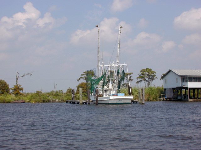
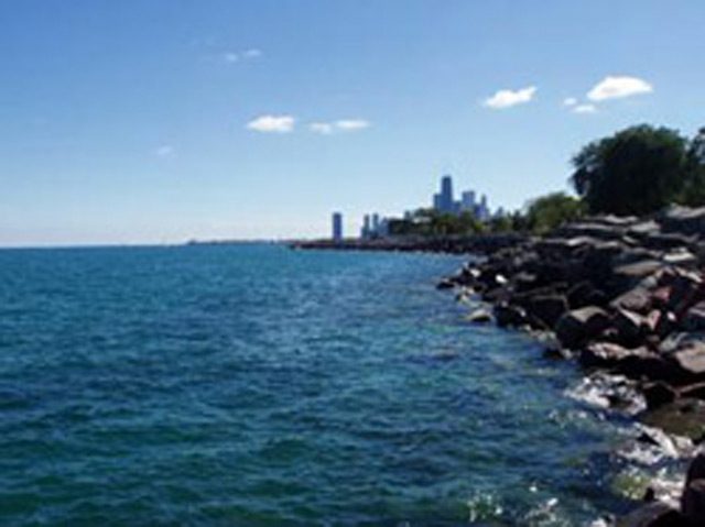
A shrimp boat. Shrimp can't survive in the oxygen-depleted water in the Dead Zone so the EPA is trying to control runoff. (Photo by Lester Graham)
The EPA has revised a plan to control polluted runoff from 31 states that
contribute to the Dead Zone in the Gulf of Mexico. But states say there needs to
be more money too. Chuck Quirmbach reports:
Transcript
The EPA has revised a plan to control polluted runoff from 31 states that
contribute to the Dead Zone in the Gulf of Mexico. But states say there needs to
be more money too. Chuck Quirmbach reports:
Fertilizers such as nitrogen and phosphorus run off farm fields in
the Mississippi River basin. The nutrients then wash down the river, leading to
excessive algae growth in the Gulf of Mexico. That creates a dead zone of
20,000 square kilometers that harms shrimp and other species.
An EPA task force has released a plan that puts the states in the lead role for
cutting nutrients. But panel member Russell Rasmussen says what’s missing are
the billions of dollars needed to shrink the Dead Zone by the stated target of
75%:
“There just haven’t been the resources brought to bear to achieve that goal and it
doesn’t look like they’re going to be there between now and 2015.”
The EPA says major environmental progress in the Gulf is less a question of cost
and more about public-private partnerships.
Fish biologists are worried about a
virus from Europe that is killing fish in the
Mississippi River. Sandra Harris reports:
Transcript
Fish biologists are worried about a virus from Europe that is killing fish in the
Mississippi River. Sandra Harris reports:
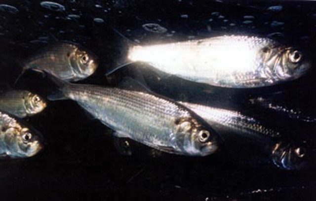
Spring Viremia is killing carp in the Mississippi River. Biologists are concerned the
virus could spread to other smaller related fish, called cyprinids, that are used for bait. Ron Benjamin is
a fish biologist with the Wisconsin Department of Natural Resources:
“Right now, we’re not seeing that happen. We see the forest base is pretty stable out there. Like I say, it does affect other cyprinids but it’s to various degrees. And so, at least so far, we haven’t seen that impact.”
Benjamin says Spring Viremia was discovered in the Mississippi in 2002 when
antibodies of the virus were found in carp. It is not harmful to humans who eat the fish.
The virus is thought to have been brought to the United States in goldfish imported from
Europe.
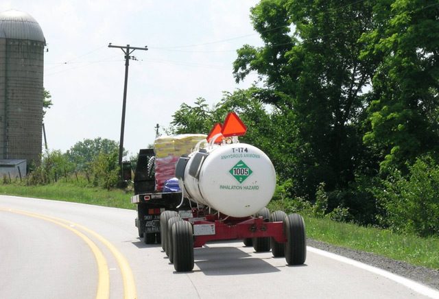
Corn requires more fossil fuel-based nitrogen fertilizer than many other crops. Tanks of pressurized anhydrous ammonia fixes nitrogen in the soil, but heavy rains can wash nitrogen into waterways. (Photo by Lester Graham)
Farmers are paid to put grassy strips to act as buffer zones along waterways. Some farmers don't sign up for the program. With higher corn prices and a moratorium on the program, more farmers might be tempted to plow right to the edge of streams. (Photo by Lester Graham)
In the fall and spring, farmers incorporate nitrogen into fields to fertilize crops. However, some of the nitrogen ends up polluting waterways. (Photo by Lester Graham)
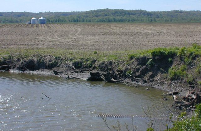
Pressure to plant more corn for ethanol will mean about 12 million acres more corn this year. It will also mean more pressure to put land into production that should be set aside to protect the environment. (Photo by Lester Graham)
Government-funded programs that pay for
conservation on farmland have done a lot to
improve the environment over the past twenty
years. The federal government has paid farmers
to take some cropland and set it aside to protect
waterways and wildlife habitat. In the second of
our two-part series on ethanol, Julie Grant reports
that some of that conservation is being stalled:
Transcript
Government-funded programs that pay for
conservation on farmland have done a lot to
improve the environment over the past twenty
years. The federal government has paid farmers
to take some cropland and set it aside to protect
waterways and wildlife habitat. In the second of
our two-part series on ethanol, Julie Grant reports
that some of that conservation is being stalled:
A good hard rain can wash a lot of valuable soil off a farm field.
John Wallbrown grows corn and soybeans on his farm. He says losing
soil is just like losing money. The soil carries with it all the
nutrients he’s put in the fields to help the crops grow, things such as
nitrogen and phosphorous. Wallbrown says he’s put in a good number of
grass waterways through the fields to help filter the water and hold on
to that soil:
“And so when you put in a grass waterway, it dramatically reduces the
amount of erosion. And it is just better for the water supply, better
for our crop. We’re keeping our soil in our field as opposed to it
getting put away.”
What Wallbrown calls nutrients in the field are considered pollution
once they wash into rivers and lakes. So Wallbrown says planting grass
near waterways is good for everyone. Except it means he’s got to use
land that otherwise could be growing crops, and that’s a loss of
income.
Wallbrown has gotten various government assistance to offset those
losses. The largest program, is called the Conservation Reserve Program, known as the
CRP for short.
John Johnson is with the US Department of Agriculture. He says when
you add up all the farms like John Wallbrown’s around the country, the
CRP is making a huge difference in reducing agricultural runoff into
waterways:
“Over 450 million tons of topsoil annually are prevented from eroding
because of CRP. We’ve got lots of really good benchmarks and measurements of
success of CRP, in both water quality, soil erosion and wildlife
habitat.”
But that set-aside land is in demand these days. There’s been a huge
call for bio-fuels to help reduce American dependence on foreign oil.
Bio-fuels are made from crops such as soybeans and corn, especially
corn. So Johnson says the government has decided to stop enrolling
new farmland into the conservation program:
“The overriding concern was that there is a need for a larger supply of
corn and soybeans and wheat production right now, so given the need for
that production, let’s just take a pause right now from enrolling large
acreage of additional farmland into the CRP.”
Corn is used to make ethanol, a fuel that’s now commonly blended with
gasoline. That’s caused corn prices to nearly double so farmers say
they’re planting 12 million acres more corn this year than last year.
That’s the most corn grown in the US in more than 50 years.
Ralph Grossi, director of the American Farmland Trust, says corn needs a
lot more nitrogen fertilizer than other crops. And when it rains,
nitrogen moves quickly from the fields to the waterways. That’s
especially true when grass strips don’t filter the runoff.
Grossi says that nitrogen drains into creeks and rivers from 36 states
into the Mississippi River and eventually to the Gulf of Mexico. There
it causes huge algae blooms that then die, sink, and the decaying
matter causes low oxygen in the water called hypoxia. That’s why the
Corn Belt has been blamed for creating a huge dead zone in the Gulf of
Mexico each year:
“If you increase corn production and don’t add the conservation practices
it will add nutrients and exacerbate problems in the gulf with hypoxia.
But it’s not just in the gulf, it’s problems for every local water
district that has to purify water for drinking and other urban
purposes. As they have to contend with more nutrients, that increases
their costs of cleaning the water.”
Grossi says the best place to clean the water is at the source. He
says that’s why the government must continue to help farmers pay for
grass waterways and buffer strips – those things prevent farm nutrients
from getting into the water in the first place. He says the need for
grass waters is even greater now that so much farmland is being planted
in corn to meet the demand for more ethanol.
A shed in Valmeyer, Ill. shows how high the water got during the 1993 Flood. The flood waters caused such damage that most of the town moved a few miles east, high up on a bluff. A few residents and many farmers, though, stayed in the flood plain. (Photo by Tom Weber)
A view of the flood plain at Valmeyer, Ill., where the Corps studied the possibility of building a new levee for the purpose of creating a "storage district." (Photo by Tom Weber)
Ron Kuergeleis (left) chats with Doug Sondag at Doug's farm in Valmeyer, Ill. The two men sit on the local levee district, which is the government body responsible for the levee's upkeep. (Photo by Tom Weber)
It’s been 13 years since the Great Flood of ’93 caused widespread destruction along the upper Mississippi River. After the flood, there was talk of needing to expand the natural floodplain by eliminating levees that protect farmland. That didn’t happen. In fact, not much of anything has happened, but that doesn’t stop farmers from wondering if the government will buy their farms and turn them into natural areas designed to take the waters of the next big flood. Tom Weber reports:
Transcript
It’s been 13 years since the Great Flood of ’93 caused widespread destruction along the
upper Mississippi Rivers. After the flood, there was talk of needing to expand the natural
flood plain by eliminating levees that protect farmland. That didn’t happen. In fact, not
much of anything has happened, but that doesn’t stop farmers from wondering if the
government will buy their farms and turn them into natural areas designed to take the
waters of the next big flood. Tom Weber reports:
For all the river talk in these parts, it’s actually kind of hard to see the water. Doug
Sondag’s farm is about about two miles from the river and his view to the west
is of the bluffs, on which Missouri towns, like Herculanium, sit.
“That’s Missouri bluffs. That’s Missouri bluffs, and to the north the bluffs that you see is Missouri.
We’re on a big bend here.”
Doug’s friend Ron Kuergeleis is visiting the farm today. Kuergeleis lost his home in the
’93 flood, but he still farms on the flood plain near Valmeyer, Illinois. The two also are
commissioners with the local levee district, which means they’re in charge of keeping the
local levee up-to-date so the river is kept away.
Today, though, they’re talking about the possibility of a new federal levee and something
called “Plan G.”
(Ron): “You’re talking quite a few farmers that would absolutely put them out of
business. You’re one of them, I’m one of them, and there’s – (Doug): “There are quite a few
more.” (Ron): “There are quite a few more.”
No one is going out of business any time soon, though. Plan G is something the Army
Corps of Engineers studied and decided wasn’t worth the money. It would have the
Corps spend billions building up bigger levees along the upper Mississippi to 500-year
levees: the highest levees the Corps builds.
Plan G also would create a huge storage district nearby. A storage district is a kind of
relief area where flood waters go to take strain off other levees. Corps engineer Richard
Astrack says design elements like these can help control flooding in other places:
“Now we have the capability that we didn’t have before to look at whole system to ensure
that actions taken at one location can impact another location.”
The Valmeyer storage district would require a new levee in the flood plain, which would
leave 10,000 acres of currently protected farmland unprotected and on the wrong side of
the levee.
This all started a few years ago, when Congress told the Corps to study the entire Upper
Mississippi River, from Illinois’s southern tip to Minnesota, find out if the current levees
are good enough to reduce flood damage. If not, should there be some comprehensive plan to guide just which levees get built up and when? Such a study actually had never been done.
The Corps’ Richard Astrack says they looked at a lot of options, including that Plan G,
to see if any of them were worth the time and money. And it turns out, none of them is:
“None of the plans passed that test. Our draft report does not
recommend any systemic plan.”
And the Corps’s final report will probably recommend essentially doing nothing because
the current system does a good enough job of preventing flood damage. The Corps will
recommend updating, but not raising, current aging levees, and also creating some mini-
levees to protect roads that approach bridges.
But even with all the assurances that Valmeyer, Illinois is safe for now, farmers in the
bottomlands are worried that the federal government might one day force their children
or their grandchildren off their farms.
Ron Kuergeleis is a fourth generation farmer:
“We’re pretty much assured in our lifetime it ain’t gonna happen. But some of us got another
generation coming up and you don’t know. He claims, you know where you going to
come up with money, but if they want to come up with it, they’ll find it.”
The worries stem from the fact that Corps cannot, in all fairness, guarantee that such a
levee would never be built. Because setting aside some of the bottom lands for natural
flooding could protect big cities such as St. Louis, Missouri and Memphis, Tennessee,
there’s concern that Congress might one day instruct the Corps of Engineers to buy out
those farms.
So, while Valmeyer is not getting a new levee right now, the people here say they’ll keep
working to stay one step ahead to make sure it never happens.
Alan Roberson's pond traps sediment. Before the pond was built, silt washed into a creek and caused problems farther downstream. (Photo by Lester Graham)
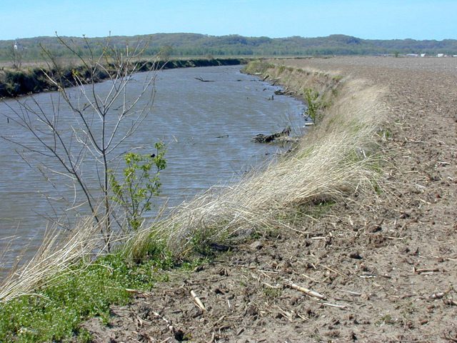
Soil erosion from farmfields causes siltation in creeks, rivers and lakes. The soil particles also carry fertilizer and pesticide pollution with them. (Photo by Lester Graham)
Since the dust bowl days of the 1930s Depression, the government has been working with farmers to reduce erosion. Today, soil conservation is better. But fields still lose a lot of topsoil because not all farmers use the best conservation methods. Dirt is washed away by rain. That silt clogs up streams, rivers and lakes. But one region is trying to intercept the silt before it gets to the river system. The GLRC’s Lester Graham reports:
Transcript
Since the dust bowl days of the 1930s Depression, the government has been working with
farmers to reduce erosion. Today, soil conservation is better. But fields still lose a lot of
topsoil because not all farmers use the best conservation methods. Dirt is washed away
by rain. That silt clogs up streams, rivers and lakes. But one region is trying to intercept
the silt before it gets to the river system. The GLRC’s Lester Graham reports:
Farm fields in all or part of 38 states drain into the Mississippi River. Some of the
tributaries of the Mississippi are so silted that dredges have to operate around the clock to keep river
shipping lanes open.
The Sangamon River in central Illinois is not big enough for shipping cargo, but it does
run into the man-made Decatur Lake. The city of Decatur gets its water from that lake
and often has to dredge it to keep the water inlets from clogging up.
Keith Alexander is the Director of Water Management for the city of Decatur, Illinois.
He says a little soil erosion on enough farms adds up:
“And the drainage area that runs into the lake is 925 square miles of some of the world’s
best topsoil. We have literally a half-a-million acres of corn and soybean fields that flow
into our lake that we use for drinking water purposes.”
Not only does the silt clog the lake, it also carries fertilizers and pesticides with it,
polluting the lake. The city has offered farmers financial incentives to reduce soil
erosion. But it hasn’t gotten enough participation from farmers to solve the problem. So,
the City of Decatur decided to try another approach. They would offer money to landowners to build ponds. Those ponds would be located in key drainage areas next
to farm fields.
Shannon Allen is a watershed specialist with the Macon County Soil and Water
Conservation District. He says it turned out to be a pretty popular program:
“The landowners wanted it for recreational purposes, obviously fish, maybe swimming
or whatever. We’re putting them in so we can collect sediment from the farm fields
above them so they don’t go into the river system.”
Shannon Allen says the ponds work a lot better at keeping silt out of creeks and rivers and lakes
than other methods to reduce erosion.
“Basically ponds collect 90% of the silt. And, so anytime you can put up a pond, you’re
doing better than a grassed waterway or a terrace that don’t reduce sediment loads by that
much.”
The city offers up to 5,000 dollars to landowners, but that’s well short of the actual cost. A typical pond
can cost 20 to 25,000 dollars to build. But landowners have been taking the city’s offer.
Alan Roberson owns a few acres at the bottom of a sloping corn field. About 42 acres
drains onto his property and then into a creek. He says when he moved there, there was
just a big ditch where stormwater from the neighboring farm fields washed a bigger and
bigger gully, carrying sediment to the creek:
“There was places eight, ten feet deep. We’ve lived here almost 20 years and it just kept
getting deeper as it went along. I hated to even come down here and look at it because it
was getting so bad. So, I’m glad that program came along to take care of it. As you can
see, it’s not doing that anymore.”
Roberson took advantage of the city’s pond program. Where the gully used to be, a carpet
of green lawn now borders a picturesque little pond.
Alan Roberson says the pond has a pipe in the bottom of it, kind of like a bathtub plug. It
was part of the design required to get the matching funds from the city. When the pond
fills up with silt, Roberson will be able to drain it and dig out the soil:
(Sound of water trickling)
“See this valve down here? You can actually pull that up. It could very well be 20 years
from now they’ll get enough silt in here where a person will have to bring it down. But
like I said, it’s designed to do that.”
That silt is some of the richest dirt in the corn belt and could be sold back to farmers or
used for gardens or flower beds. The landowner will have to pay the cost of digging it
out, but it’s that much more silt that won’t have to be dredged from the lakes or the rivers
that feed them, where people get their public water supply.
Scientists say the size of this year’s dead zone in the Gulf of Mexico is bigger than average. It’s grown to more than 65-hundred square miles in size. The GLRC’s Mark Brush explains:
Transcript
Scientists say the size of this year’s dead zone in the Gulf of Mexico is bigger than
average. It’s grown to more than 6,500 square miles in size. The Great Lakes Radio
Consortium’s Mark Brush explains:
Each spring, scientists measure the amount of nitrogen and phosphorus pollution coming
down the Mississippi river. The excess nutrients mostly come from farm fields and
sewage treatment plants in the Mississippi river basin. The nutrients cause algae blooms
in the Gulf of Mexico which eventually rob the water of its oxygen.
Dave Whittall is with the National Oceanic and Atmospheric Administration. He says
the dead zone has a big impact on the region’s ecology and economy:
“That whole area where we don’t have oxygen, nothing can live there, so this is an area
the size of the states of Connecticut and Rhode Island put together where you have no
aquatic life essentially.”
Government officials are working toward a goal of cutting the size of the dead zone by
half in the next nine years. And they’re looking to farmers and cities to help them with
that goal.
Water diversion is an increasing threat to the Great Lakes. As communities grow so does the demand. (Photo by Brandon Bankston)
We’re continuing the series, Ten Threats to the Great Lakes. Our field guide through the series is Lester Graham. He says our next report looks at where the demand for water will be greatest:
Transcript
We’re continuing the series Ten Threats to the Great Lakes. Our field
guide through the series is Lester Graham. He says our next report looks
at where the demand for water will be greatest.
Right around the Great Lakes is where there’s going to be more demand
for drinking water. Water officials say as cities and suburbs grow, so
does the need for water. Some towns very near the Great Lakes say they
need lake water right now, but in some cases they might not get it. The
Great Lakes Radio Consortium’s Christina Shockley reports:
People who live around the Great Lakes have long used the lakes’ water
for transportation, industry, and drinking water. Most of the water we
use, gets cleaned up and goes back in the lakes.
That’s because the Great Lakes basin is like a bowl. All the water used
by communities inside that bowl returns to the lakes in the form of
groundwater, storm water runoff, and treated wastewater, but recently, thirsty
communities just outside the basin—outside that bowl—have shown an
interest in Great Lakes water.
Dave Dempsey is a Great Lakes advisor to the environmental group
“Clean Water Action.”
“We are going to be seeing all along the fringe areas of the Great Lakes
basin all the way from New York state to Minnesota, communities that
are growing and have difficulty obtaining adequate water from nearby
streams or ground water.”
Treated water from those communities won’t naturally go back to the
basin. Treated wastewater and run-off from communities outside the
Great Lakes basin goes into the Mississippi River system, or rivers in the
east and finally the Atlantic Ocean.
The Great Lakes are not renewable. Anything that’s taken away has to be
returned. For example, when nature takes water through evaporation, it
returns it in the form of rain or melted snow. When cities take it away, it
has to be returned in the form of cleaned-up wastewater to maintain that
careful balance.
Dave Dempsey says the lakes are like a big giant savings account, and
we withdraw and replace only one percent each year.
“So, if we should ever begin to take more than one percent of that
volume on an annual basis for human use or other uses, we’ll begin to
draw them down permanently, we’ll be depleting the bank account.”
Some of the citiesthat want Great Lakes water are only a few miles from
the shoreline. One of the most unique water diversion requests might come
from the City of Waukesha, in southeastern Wisconsin. The city is just 20 miles
from Lake Michigan. Waukesha is close enough to smell the lake, but it
sits outside the Great Lakes basin. Waukesha needs to find another
water source because it’s current source – wells—are contaminated with
radium.
Dan Duchniak is Waukesha’s water manager. He says due to the city’s
unique geology, it’s already using Great Lakes water. He says it taps an
underground aquifer that eventually recharges Lake Michigan.
“Water that would be going to Lake Michigan is now coming from Lake
Michigan…. our aquifer is not contributing to the Great Lakes any more,
it’s pulling away from the Great Lakes.”
Officials from the eight Great Lakes states and Ontario and Quebec
recently approved a set of rules that will ultimately decide who can use
Great Lakes water. The new rules will allow Waukesha—and some
other communities just outside the basin—to request Great Lakes water,
and drafters say Waukesha will get “extra credit” if it can prove it’s
using Lake Michigan water now.
Environmentalists are still concerned that water taken from the Lakes be
returned directly to the Lakes, but some say even that could be harmful.
Art Brooks is a Professor of Biological Sciences at the University of
Wisconsin- Milwaukee. He says the water we put back still carries some
bi-products of human waste.
“No treatment plant gets 100 percent of the nutrients out of the water,
and domestic sewage has high concentrations of ammonia and
phosphates. Returning that directly to the lake could enhance the growth
of algae in the lake.”
That pollution could contribute to a growing problem of dead zones in
some areas of the Great Lakes. Brooks and environmentalists concede
that just one or two diversions would not harm the Great Lakes, but they
say one diversion could open the floodgates to several other requests, and
letting a lot of cities tap Great Lakes water could be damaging.
Derek Sheer of the environmental group “Clean Wisconsin” says some
out-of-basin communities have already been allowed to tap Great Lakes
water under the old rules.
“The area just outside of Cleveland–Akron, Ohio– has a diversion
outside of the Great Lakes basin, so they’re utilizing Great Lakes water
but they’re putting it back.”
There are several communities that take Great Lakes water, but they, too,
pump it back. The new water rules still need to be ok-ed by the legislature of
each Great Lakes state, and Congress. Since the rules are considered a
baseline, environmental interests throughout the region say they’ll lobby
for even stricter rules on diversions.
Because alewives are the main source of food for some sport fish, some people forget that they're an invasive species. (Photo courtesy of NOAA Fishery Service)
As we look at the “Ten Threats to the Great Lakes,” we’re spending some time examining the effects of the alien invasive species that have changed the Lakes. One of the first invasive species to arrive in the Great Lakes was the alewife; it’s native to the Atlantic Ocean. It has become the most beloved of all the invasives. That’s because it’s food for the most popular sport fish in the Great Lakes. But in the beginning, the sport fish was introduced to get rid of the alewives. Peter Payette reports:
Transcript
Today we’re continuing our series on Ten Threats to the Great Lakes. The Great Lakes Radio Consortium’s Lester Graham is our series guide:
As we look at the “Ten Threats to the Great Lakes,” we’re spending some time examining the effects of the alien invasive species that have changed the Lakes. One of the first invasive species to arrive in the Great Lakes was the alewife; it’s native to the Atlantic Ocean. It has become the most beloved of all the invasives. That’s because it’s food for the most popular sport fish in the Great Lakes. But in the beginning, the sport fish was introduced to get rid of the alewives. Peter Payette reports:
When autumn arrives in Northern Michigan, salmon fishermen line the rivers. The fish, native to the Pacific Ocean, swim upstream to spawn and then die. That’s why Tim Gloshen says they’re not interested in his bait.
“But if you irritate ’em enough and keep putting it in front of them, they’ll snap at it sometimes and you got to be ready when they hit it and set your hook.”
Anglers caught eight million pounds of salmon in Lake Michigan last year. Most of the fish are caught out in the lake.
“I got buddies that are catching couple hundred a year out there. They’re out there twice a week at least, all summer long, you know.”
Tim and his buddies and everyone else who fishes for salmon in the Great Lakes are at the top of the food chain. The money they spend on food, lodging, tackle, and boats figures heavily into decisions about how to manage the Lakes.
But it wasn’t always so.
Pacific salmon were stocked here about forty years ago to control the invading alewives. The native lake trout had just about been wiped out by overfishing and the sea lamprey. With no big predators left, the alewife population exploded.
At one point, it was estimated that for every ten pounds of fish in Lake Michigan, eight were alewives. Occasional die-offs would cause large numbers of alewives to wash up on beaches all over the Great Lakes. Historian Michael Chiarappa says all this was happening as America was feeling the urge to get back in touch with nature.
“And that’s when you get this rise in greater interest in sport fishing, recreational fishing, hunting. Teddy Roosevelt sort of epitomized the spirit of the strenuous life; get back out there and engage nature. It’s good for the soul, it’s good for the body, it’s good for the mind.”
So the salmon was brought in to control the alewife population and transform the Great Lakes into a sport fishing paradise. And it worked. But alewives remained the best food source for the ravenous salmon.
So now a healthy alewife population is seen as a good thing by the states that benefit economically from the recreational fishing. Mark Holey, with the U.S. Fish and Wildlife Service says this has caused people to forget alewives are an invasive species.
“If alewives were knocking on the door today, there may be a much different discussion about it. It may be more like the Asian carp.”
How the alewife would compare to Asian carp is unknown, because the Asian carp has been found in the Mississippi River, but not yet in the Great Lakes. What is known is that when alewives are abundant, native fish don’t do well. For example, Holey says biologists used to think PCBs caused many young lake trout to die. Now they know early mortality is mostly due to thiamin deficiency.
Thiamine is a vitamin lacking in lake trout that eat too many alewives.
“From the studies that we’ve been involved with, anywhere, right now, anywhere between thirty to fifty percent of the females that we take eggs from show some… their eggs show some signs of thiamine deficiency. Which means survival of those eggs are impaired.”
In some cases, none of the eggs will survive. So a worse case estimate would be half of the wild lake trout in the Great Lakes can’t reproduce because of alewives. This is why advocates for native fish species have been happy to see the alewife populations decline in recent years. They almost disappeared from Lake Huron.
Mark Ebener is a fisheries biologist for the Chippewa Ottawa Resource Authority. He says the government agencies that stock salmon and lake trout should stock more than ever to keep pressure on the alewife. Ebener thinks with alewife numbers down, there’s an opportunity to reestablish the native herring as the main prey fish in the Lakes, especially in Lake Huron.
“Saginaw Bay used to have a huge population of lake herring that’s essentially gone. They used to have a tremendous commercial fishery for it, and people used to come from miles around to buy herring there, and everybody in the lower end of the state used to have herring come fall and the springtime when the fishers were fishing, but they’re gone.”
This opportunity to bring herring back might not last much longer. The warm weather this past summer will probably help alewives rebound next year.
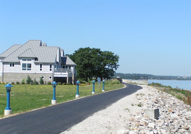
A former industrial site is being redeveloped with parks, wetlands and homes. Residents have high hopes the new development will boost the local economy. (Photo by Shawn Allee)
A riverfront park is part of the redevelopment.
(Photo by Shawn Allee)
Brownfield redevelopers are hoping to entice people to live along the riverfront, too. (Photo by Shawn Allee)
As the American economy shifts away from heavy industry, each closed factory risks becoming a brownfield. That’s a site that contains potentially hazardous materials. For the past decade, the federal government has provided help in assessing and cleaning these properties. It has proved to be one of the most popular environmental programs. It’s giving hope to small towns that need help in remaking their landscapes. The Great Lakes Radio Consortium’s Shawn Allee reports:
Transcript
As the American economy shifts away from heavy industry, each closed factory
risks becoming a brownfield. That’s a site that contains potentially
hazardous materials. For the past decade, the federal government has provided help in assessing and
cleaning these properties. It has proved to be one of the most popular environmental programs. It’s
giving hope to small towns that need help in remaking their landscapes. The Great Lakes Radio Consortium’s Shawn Allee reports:
When a Rust Belt city loses another factory, the townspeople don’t suffer
just from the loss of jobs. They’re often stuck with crumbling buildings or even polluted land. Not to mention, the local economy isn’t strong enough to fix them up.
It’s a dilemma familiar to East Moline, a small Illinois town that sits
along the banks of the Mississippi River. Since the early 80s, the town’s lost thousands of jobs in the farm machinery
industry. Rich Keehner is the City of East Moline’s assistant administrator. He says
there is a plan for the industrial riverfront.
“Right now there’s a movement to relocate or pull industrial uses from the
river. And then of course turn that riverfront property into bike paths or some
recreational activities to improve our quality of life. And that’s exactly
what we’re doing here.”
It’s a simple idea: move industry away from the river and work with
developers to make it an attractive place to play or even live. But it’s just not that easy. Keehner says developers won’t build on these sites until it’s clear what kind
of pollution, if any, might be there.
Testing the area’s soil and water can get expensive, so sites can remain
empty for years. Meanwhile, developers look for greener pastures. Really, they can just build on farmland instead.
During the past decade, the U.S. EPA’s paid for pollution testing at hundreds
of sites. The agency also funds some cleanup and other costs. East Moline’s used several grants to develop eighty acres of riverfront donated
by the John Deere Company.
With the Mississippi riverbank at his back, Keehner points out some new
houses developed on the site.
“It’s got some great amenitities, located next to the bike path. You
can just wake up any time night or day and look out at the river. And your
neighbors are very limited; it’s very peaceful.”
The district also boasts a small light house, a lot of park space, and some
wetlands areas. Keehner says brownfields grants funded about six percent of the project’s
total cost. That doesn’t sound like much, but the money’s played a key role. He says private money couldn’t be secured until there was progress on the
environmental front.
A lot of environmentalists and civic groups applaud the program even though
a lot of credit goes to someone they often criticize. Namely, President
George Bush. His critics admit the brownfields program is one of the brighter spots of
his environmental policy.
In 2002, President Bush signed legislation that expanded the program’s
funding and breadth. Alan Front is the vice president of the Trust for Public Land, a
conservation group.
“The administration, ever since signing that bill, has budgeted about 200
million dollars a year to make this program really vibrant and so not only
have they created the wallet, but they’ve filled it in a way that really
benefits communities around the country.”
Front says the expansion’s brought a tighter focus on the environmental
needs of smaller towns. Apart from the grants, there’s another reason for the program’s popularity. The EPA trains city administrators to use federal brownfield money to
leverage private dollars.
Charles Bartsch has been teaching such courses for ten years.
He says, to compete with larger cities, smaller towns need to show they
understand their local economies.
“I suggest to towns what they should do first of all is to decide what their
competitive economic niche is.”
That means, developing around a community asset, like East Moline’s tried
with its attractive riverfront. Bartsch says, for all the progress small town administrators have made, they’re still pretty isolated. He says they need to cast a wide social net, so
they can find the best advice.
“The key thing is less knowing how to do it yourself, but more knowing who to
reliably call to walk through ideas and walk through options.”
The brownfields program does have its critics. They say it’s tilted in favor
of land development over open space and they worry about how much oversight
there is of environmental testing.
Back at the East Moline site, it’s easy to see why small towns are
participating. Residents there now have more access to the river, bike paths, parks, and,
for some people, new homes. East Moline, and a lot of other small towns like it, are seeking even more brownfields money.
They’ve got a lot of other sites that want a chance at a new life.