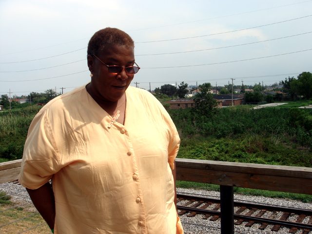
 Pam Dashiell is with the Lower 9th Ward Center for Sustainable Engagement and Development. The Lower 9th Ward is in the background. (Photo by Samara Freemark)

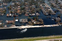
Four years ago, Hurricane Katrina
hit New Orleans. The city still
hasn’t figured out how to protect
itself. Most of the conversation
focuses on rebuilding the city’s
levees. But some people in New
Orleans are starting to think beyond
levees. They call their strategy
resilience planning. And they think
New Orleans can become America’s
leader in it. Samara Freemark reports:
Transcript
Four years ago, Hurricane Katrina
hit New Orleans. The city still
hasn’t figured out how to protect
itself. Most of the conversation
focuses on rebuilding the city’s
levees. But some people in New
Orleans are starting to think beyond
levees. They call their strategy
resilience planning. And they think
New Orleans can become America’s
leader in it. Samara Freemark reports:
When Pam Dashiell moved back to New Orleans after Hurricane Katrina, she couldn’t believe what people were saying about her neighborhood.
“People were saying, well, the 9th Ward should be a drainage ditch. There’s no way it can possibly come back.”
Dashiell is the co-director of the Lower 9th Ward Center for Sustainable Engagement and Development. And after the storm, she became one of the leaders demanding the city be built back exactly as it had been before. New houses put up wherever old ones had been knocked down. Social services restored to all neighborhoods. And most importantly, levees. Levees big enough and strong enough to protect the city from anything a hurricane could throw at it.
“That was the fundamental argument and discussion back then. That was the battle.”
But Dashiell’s thinking has changed over the past couple of years. The levees that were promised after Katrina still haven’t been completed. Dashiell says eventually she gave up on them and started looking for other solutions.
“You’ve got to move. You’ve got to go forward. At this point we are not protected. So we gotta act like that and deal accordingly.”
“Levees and stuff like that are great, but they’re not going to be the salvation of this area.”
That’s Marco Cocito-Manoc. He’s with the Greater New Orleans Foundation. They’re one of the groups involved in rebuilding the city.
“We can’t just lobby for bigger walls, higher walls. The truth is that New Orleans can never be sufficiently protected from flooding. So everyone has to adopt what in this area is a brand new mindset.”
Cocito-Manoc calls that new mindset “resilience planning”. That’s making small, local changes to help the city manage flood water, rather than trying to hold it back at all costs.
It’s a strategy that’s being implemented in the Lower 9th Ward by Pam Dashiell’s group and others. A lot of these groups have moved away from pushing for more levees. Instead, they’re building raised houses on higher ground, and making sure they’re properly weatherized. They’re perfecting evacuation plans, so when evacuations do happen, they’re quick and orderly. And they’re installing permeable surfaces and rain gardens to reduce surface water. These kinds of changes won’t prevent flooding, but they’ll limit the devastation that sometimes goes along with it.
Cocito-Manoc says measures like these could actually set an example for other cities that will face rising sea levels in the next century. Think New York, or Miami, or Boston.
“I know that it’s difficult to see New Orleans as leading in much. But I think this is really our opportunity to become a global center for learning how to cope with water, and use water as an asset rather than as something that threatens our existence.”
As for Pam Dashiell, her focus right now is on the Lower 9th Ward. I asked her how she imagined the future of her neighborhood.
“I would see rain gardens. Strong green infrastructure. I see a new sewer system. I see the lower 9th ward recognized as a community that helped lead the way to a more sustainable future. (Laughs) I got good dreams.”
For The Environment Report, I’m Samara Freemark.