FIGHT FOR AMERICA’S LONGEST RIVER (Part 1)

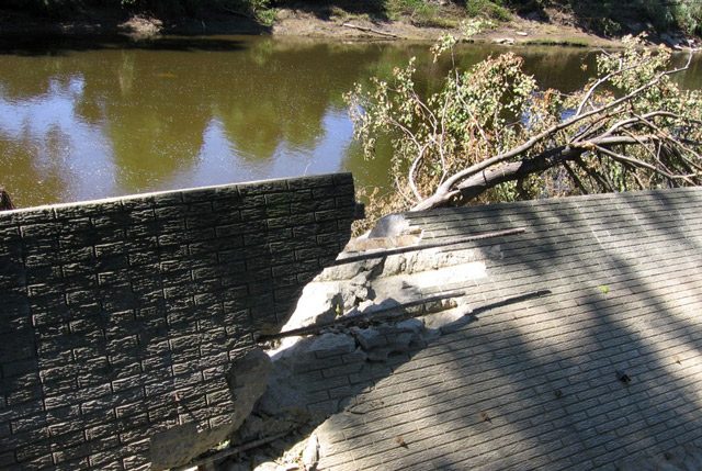
  • Wing dams along the Missouri River force the flow of water to the center, scouring the bottom of the river. Environmentalists say the Missouri has been turned into little more than a big ditch for barges. They support management plans that restore habitat for wildlife. (Photo by Lester Graham)

Rivers have been the life-blood of commerce in the United States since the
nation’s beginning. In 200 years, the machines of trade have evolved from flat-
bottomed wooden boats to today’s steel-hulled river barges. The rivers link
America’s natural resources with the industrial cities that propel its economy.
Decades of damming and dredging have turned the big rivers into shipping
channels. But in recent years, competing interests have argued in defense of
other uses of the rivers. In the first of three reports, Kevin Lavery looks at how
those groups seek to balance the economy and ecology:

Transcript

Rivers have been the life-blood of commerce in the United States since the
nation’s beginning. In 200 years, the machines of trade have evolved from flat-
bottomed wooden boats to today’s steel-hulled barges. The rivers link
America’s natural resources with the industrial cities that propel its economy.
Decades of damming and dredging have turned the big rivers into shipping
channels. But in recent years, competing interests have argued in defense of
other uses of the rivers. In the first of three reports, Kevin Lavery looks at how
those groups seek to balance the economy and ecology:


Long before interstates and over the road trucking, America moved its goods on
the water. River barges carry just about any kind of commodity. They emit less
pollution than trucks and trains… and the river route is cheaper than both the road
and the rail.


The nation’s farms, coal mines and quarries depend on rivers like the Mississippi,
Ohio and Missouri to keep their products moving. Business is healthy on the
Mississippi and the Ohio. But on the Missouri, barges carry just a third of the
cargo they did 30 years ago. Many shippers say drought and overregulated dam
releases make the water levels too unreliable to plan the big hauls that bring in
the most profit.


Paul Davis runs Interstate Marine Terminals, 200 miles upstream from where the
Missouri River meets the Mississippi, near St. Louis. He ships and stores
fertilizer from his dock. But Davis says when the river runs low, barges are not
his best option:


“The real adjustment that I’ve made is going from river to rail.”


Logistically, the adjustment is easy. The Union Pacific railroad line runs just a
few feet from Davis’ dock. But it costs him about 15 dollars more per ton to move
goods by rail. Davis says river barges might be profitable again if old feuds over
water management would end:


“There’s business out there. It could come back if people quit fighting and start agreeing
and confidence would return to shipping on the Missouri River. But I can’t afford to wait
and see… I’ve got to make adjustments.”


The fighting puts business against the environment. Shippers want enough
water to move freight. But environmentalists want the river to rise and recede
like it did before the Army Corps of Engineers started changing it.


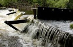
The conflict goes back to the 1930’s. Congress ordered the Corps to make the
river safe for barges. That meant clearing snags and sandbars from a 735-mile
stretch from Sioux City, Iowa to St. Louis, Missouri. The Corps also confined the
river with earthen levees. Opponents say it turned the Missouri into a
characterless ditch.


The Corps spends 7 million dollars a year to maintain the channel. Spokesman
Paul Johnston says despite the dwindling volume of river traffic, the Corps is
mandated to keep the river open:


“The Corps of Engineers, like any federal agency, does not have the option to pick and
choose which laws it’s going to obey and not obey.”


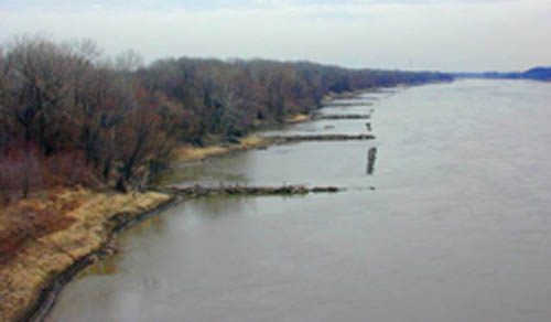
But critics say wildlife has paid for the Corps’ mandate. Over the years, dams
and channels eliminated a half a million acres of wetland habitat. Birds lost their
sandbar nesting grounds, and fish no longer found shallow backwaters to lay their
eggs.


Among the hardest hit animals is the pallid sturgeon. It’s a long, flat-nosed fish
that dates back to the T-Rex. It’s been around 70 million years, and for the last
17, it’s been on the endangered species list.


Chad Smith directs the Nebraska field office of the environmental group
American Rivers. He says the pallid sturgeon’s fate shows the whole river is in
jeopardy:


“When it starts to decline, you know, that kind of creature that’s so in tune with the
Missouri as it was, is an indicator that maybe something’s not right, and it’s going to be
the first thing to fall.”


So Congress told the Corps to take on a recovery mission. The agency spends
more than 50 million dollars a year to rebuild shallow water habitat for fish and
birds. The Corps hopes a water resources bill pending in Congress will increase
its habitat restoration budget to 80 million dollars.


In 2006, the Corps launched its most controversial restoration program to date. It
released extra water from a South Dakota reservoir to mimic the natural flood
pulse that occurs on the Missouri River every spring. That triggers the sturgeon
to spawn.


Conservationists herald last year’s man-made spring rise as a long overdue sign
of progress. But barge companies on the lower Missouri are upset. They say
the spring rise brings a drop in the river’s depth in the summer… which means
less cargo they’re carrying and less money they’re making.


For The Environment Report, I’m Kevin Lavery.


ANCHOR TAG: Tomorrow, Kevin reports on the commercial barge
industry’s concerns over the Army Corps of Engineers’ control of the big
rivers.

Related Links

FIGHT FOR AMERICA’S LONGEST RIVER (Part 2)

  • Barge companies question the science of the Army Corps of Engineers' studies that indicate habitat restoration and changes in river management help threatened species and other wildlife. (Photo by Lester Graham)

The US economy relies heavily on the nation’s rivers to transport goods bound
for foreign markets. Each year river barges carry hundreds of millions of
tons of cargo to busy ports. Traffic is bustling on some rivers, but it’s dying on
others. Commercial shippers say their situation is made worse by attempts to
balance their interests against conservation. In the second of three reports,
Kevin Lavery explains why some barge companies say mismanagement is
squeezing them out of the marketplace:

Transcript

The US economy relies heavily on the nation’s rivers to transport goods bound
for foreign markets. Each year river barges carry hundreds of millions of
tons of cargo to busy ports. Traffic is bustling on some rivers, but it’s dying on
others. Commercial shippers say their situation is made worse by attempts to
balance their interests against conservation. In the second of three reports,
Kevin Lavery explains why some barge companies say mismanagement is
squeezing them out of the marketplace:


In 2004, America celebrated the bicentennial of Lewis and Clark’s Corps of
Discovery mission to the West. At the start of the 19th century, the Missouri River
was center stage in an age of discovery.


By the start of the 21st century, the river was in an age of discontent. Riverboat
companies, environmentalists, Indian tribes and state governments were
deadlocked in legal battles over water releases.


Paul Davis’ shipping terminal in Boonville, Missouri has been around for 36
years. In 2004, he watched two major shippers call it quits. One of them,
Blaskey Marine, was a family venture:


“And Blaskey had been in the towboat business on the Missouri River for as long as I can
recall, and business just got too tough for them, so they just gave it up. And that’s what
really was the beginning of the end in our involvement with barges, at least for the time
being.”


Industry watchers say the riverboats have been clanging their death knell for
a long time. In 1977, barges carried just over 3 million tons of cargo. Since then,
floods, drought and market forces have cut barge shipments by two-thirds. Chad
Smith is with the environmental group American Rivers in Lincoln, Nebraska:


“They don’t move a lot of tons, and agriculture basically dictates that grain moves the
market by truck and rail. Everybody agrees those numbers don’t lie.”


But everyone doesn’t agree. Paul Rhode is with the national shipping advocacy
group Waterways Council, Incorporated:


“People say barge traffic is dying on the Missouri. That’s not true. Barge traffic is being
killed by the way the Missouri river is managed right now.”


Rhode blames the industry’s woes on the Army Corps of Engineers, the federal
agency that regulates the Missouri River.


In May 2006, the Corps released more water than usual from a South Dakota
reservoir. The rise was meant to tell an endangered fish, the pallid sturgeon, to
spawn. Rhode says that artificial rise in the spring later lowered the river’s depth
in the summer. He says unpredictable flows kept shippers from carrying a lot of
freight… and making long-term plans:


“The levels could be managed much better. We don’t need a spring rise. We need water
down here in August and September. Barge traffic has been cut short by leaps and
bounds over the past few years, in part because of the spring rise issue.”


How short? Despite heavy rains earlier this year, the Corps plans to shorten the
navigation season by at least 45 days. That means shippers who normally finish
in December will be lucky to still be hauling by Halloween.


But there’s only so much water that can be released from upstream
reservoirs… and the Corps stands by its decision to raise the river. Spokesman
Paul Johnston says biologists are encouraged by the data they’re seeing on the
pallid sturgeon. And he says the man-made flood pulses are minor:


“They’re certainly not aggressive, at least in our perspective, and I know that there are
people who think that it’s too much too soon. But if we don’t do anything, then we
certainly will not have any data to back up any decisions.”


Historically, the Corps’ decisions tended to favor riverboats, especially in the
1930’s, when the Corps turned 735 miles of the Missouri into a shipping channel.
American Rivers’ Chad Smith says while that was viewed as the best course for
the river then, its time to set a new one:


“It’s now the year 2007 and I think our hopes and dreams have changed. And it’s probably
time for Congress to go back and see what’s happening in this basin with market forces in
agriculture and a lot of these big drivers that put pressure on the way we use and manage
the Missouri now, and see if there are things we need to do differently.”


Smith suggests some of those uses of the Missouri River might be changing
soon. With their balance sheets already razor-thin, barge operators worry those
changes might sink them.


For The Environment Report, I’m Kevin Lavery.


ANCHOR TAG: Tomorrow, Kevin reports on how the recreation and wildlife
preservation search for their place on the Missouri River.

Related Links

FIGHT FOR AMERICA’S LONGEST RIVER (Part 3)

  • Finding a balance between natural habitat and commerce on America's rivers is causing problems. (Photo by Lester Graham)

When Lewis and Clark traveled up the Missouri River 200 years ago, they
recorded the abundant wildlife they saw along their way. Fur trapping was a
thriving industry on Frontier Rivers. But it took another 100 years of over-hunting
for the US to realize it was wiping out its wildlife. Today, conservation,
commerce and tourism all intersect on the nation’s big rivers. Each of those
industries relies on a steady supply of water. In the last of three reports, Kevin
Lavery looks at how all of those interests share – and struggle – over water:

Transcript

When Lewis and Clark traveled up the Missouri River 200 years ago, they
recorded the abundant wildlife they saw along their way. Fur trapping was a
thriving industry on Frontier Rivers. But it took another 100 years of over-hunting
for the US to realize it was wiping out its wildlife. Today, conservation,
commerce and tourism all intersect on the nation’s big rivers. Each of those
industries relies on a steady supply of water. In the last of three reports, Kevin
Lavery looks at how all of those interests share – and struggle – over water:


The Missouri River is known as the Big Muddy. Sure, it’s muddy at its mouth
where it joins the Mississippi River near St. Louis. But a thousand miles
upstream, the Missouri cuts a gleaming blue ribbon through Bismarck, North
Dakota. It looks like paradise to Mike Peluso… and with a broad smile, he rushes
his boat smack into the middle of it.


Peluso grew up fishing on this river. It’s a place brimming with history. Lewis
and Clark camped here in 1804. As he’s fishing, Peluso points to a frontier-era
fort that now sits within a state park:


“That’s actually where Custer started off, right up there before he went to his final… Here’s
a bite!”


Peluso lands a 4-pound walleye. It’s the most abundant fish species in the upper
Missouri system, and he wants to keep it that way:


“Just going to let her go down. You know, hopefully my kids at some point in time will get
to enjoy the same thing I just did. (SPLASH). Oh yeah… she took off. Perfect.”


Fishing on the Missouri River is crucial to North Dakota’s economy. In the 1950’s
the Army Corps of Engineers dammed the Missouri River 80 miles north of
Bismarck. The formation of Lake Sakakawea gave rise to a 150 million dollar
annual recreation industry.


That industry largely exists because of the US Fish and Wildlife Service. The
Garrison Dam National Fish Hatchery breeds 80% of the state’s game fish.
There’s about 70 million walleye eggs in one building alone. But officials here
also care for fish that are never meant to be caught.


Rob Holm is with the Fish and Wildlife Service. He watches several pallid
sturgeons circling an 8,000 gallon tank. Each five-foot fish weighs about 60
pounds. The pallid has survived for 70 million years. But Holm says threats to
its habitat have made it an endangered species:


“If we can change things just enough to give them a fighting chance, I think it’s a good
thing. They’ve been around since the time of the dinosaurs. If we miss a beat on it now…
they’re not going to be there in 10 years.”


The pallid sturgeon was harvested for its caviar before it was federally protected.
But illegal catches still happen. Environmental groups see the pallid as a
barometer that gauges the overall health of the Missouri River. Chad Smith runs
the Nebraska field office of American Rivers:


“We lose the pallid sturgeon, that’s an indication that we may start to see problems with
the catfish and the paddlefish and the mallards and the bass, and then people are really
going to start screaming.”


The pallid sturgeon needs deep water to lay its eggs. In 2006, the Army Corps of
Engineers released extra water from a South Dakota reservoir to mimic the flood
pulse that cues the fish’s reproduction. It was a highly controversial act 15 years
in the making:


“I’m uncomfortable with the Corps playing God.”


Paul Rhode is with the national shipping advocacy group Waterways Council,
Incorporated. He says the artificial rise meant dropped water levels later in the summer.
That hurt commercial barge operators. Rhode questions the Corps’ methods:


“I hope there are studies going on to try to capture whatever it is that they’re doing to justify
having a spring rise. In past years it was to stimulate least tern and piping plover
populations, and then it was discovered that there was no science behind that. That was
just guesswork.”


The interior least tern and the piping plover are two birds that are also protected
by the Endangered Species Act. Spokesman Paul Johnston says the Corps has
evidence that its methods are working:


“Near Ponca, Nebraska we dredged out an old channel that had been closed off to create
shallow water habitat for the sturgeon and created an island. It was still being groomed
when the terns and plovers began nesting on it. We had to shut the bulldozer operator
down.”


The Corps says it understands the needs of all the different interests along the
Missouri River. That’s why it’s agreed to pay for an independent scientific study
of its habitat construction program. That study is expected to begin this fall. The
Corps says it’s still committed to trying to find a balance between nature and
business on America’s longest river. But barge owners, sportsmen and
environmentalists will try to tip that balance in their favor.


For The Environment Report, I’m Kevin Lavery.

Related Links

The Costs of Preventing Flood Damage

  • A shed in Valmeyer, Ill. shows how high the water got during the 1993 Flood. The flood waters caused such damage that most of the town moved a few miles east, high up on a bluff. A few residents and many farmers, though, stayed in the flood plain. (Photo by Tom Weber)

It’s been 13 years since the Great Flood of ’93 caused widespread destruction along the upper Mississippi River. After the flood, there was talk of needing to expand the natural floodplain by eliminating levees that protect farmland. That didn’t happen. In fact, not much of anything has happened, but that doesn’t stop farmers from wondering if the government will buy their farms and turn them into natural areas designed to take the waters of the next big flood. Tom Weber reports:

Transcript

It’s been 13 years since the Great Flood of ’93 caused widespread destruction along the
upper Mississippi Rivers. After the flood, there was talk of needing to expand the natural
flood plain by eliminating levees that protect farmland. That didn’t happen. In fact, not
much of anything has happened, but that doesn’t stop farmers from wondering if the
government will buy their farms and turn them into natural areas designed to take the
waters of the next big flood. Tom Weber reports:


For all the river talk in these parts, it’s actually kind of hard to see the water. Doug
Sondag’s farm is about about two miles from the river and his view to the west
is of the bluffs, on which Missouri towns, like Herculanium, sit.


“That’s Missouri bluffs. That’s Missouri bluffs, and to the north the bluffs that you see is Missouri.
We’re on a big bend here.”


Doug’s friend Ron Kuergeleis is visiting the farm today. Kuergeleis lost his home in the
’93 flood, but he still farms on the flood plain near Valmeyer, Illinois. The two also are
commissioners with the local levee district, which means they’re in charge of keeping the
local levee up-to-date so the river is kept away.


Today, though, they’re talking about the possibility of a new federal levee and something
called “Plan G.”


(Ron): “You’re talking quite a few farmers that would absolutely put them out of
business. You’re one of them, I’m one of them, and there’s – (Doug): “There are quite a few
more.” (Ron): “There are quite a few more.”


No one is going out of business any time soon, though. Plan G is something the Army
Corps of Engineers studied and decided wasn’t worth the money. It would have the
Corps spend billions building up bigger levees along the upper Mississippi to 500-year
levees: the highest levees the Corps builds.


Plan G also would create a huge storage district nearby. A storage district is a kind of
relief area where flood waters go to take strain off other levees. Corps engineer Richard
Astrack says design elements like these can help control flooding in other places:


“Now we have the capability that we didn’t have before to look at whole system to ensure
that actions taken at one location can impact another location.”


The Valmeyer storage district would require a new levee in the flood plain, which would
leave 10,000 acres of currently protected farmland unprotected and on the wrong side of
the levee.


This all started a few years ago, when Congress told the Corps to study the entire Upper
Mississippi River, from Illinois’s southern tip to Minnesota, find out if the current levees
are good enough to reduce flood damage. If not, should there be some comprehensive plan to guide just which levees get built up and when? Such a study actually had never been done.


The Corps’ Richard Astrack says they looked at a lot of options, including that Plan G,
to see if any of them were worth the time and money. And it turns out, none of them is:


“None of the plans passed that test. Our draft report does not
recommend any systemic plan.”


And the Corps’s final report will probably recommend essentially doing nothing because
the current system does a good enough job of preventing flood damage. The Corps will
recommend updating, but not raising, current aging levees, and also creating some mini-
levees to protect roads that approach bridges.


But even with all the assurances that Valmeyer, Illinois is safe for now, farmers in the
bottomlands are worried that the federal government might one day force their children
or their grandchildren off their farms.


Ron Kuergeleis is a fourth generation farmer:


“We’re pretty much assured in our lifetime it ain’t gonna happen. But some of us got another
generation coming up and you don’t know. He claims, you know where you going to
come up with money, but if they want to come up with it, they’ll find it.”


The worries stem from the fact that Corps cannot, in all fairness, guarantee that such a
levee would never be built. Because setting aside some of the bottom lands for natural
flooding could protect big cities such as St. Louis, Missouri and Memphis, Tennessee,
there’s concern that Congress might one day instruct the Corps of Engineers to buy out
those farms.


So, while Valmeyer is not getting a new levee right now, the people here say they’ll keep
working to stay one step ahead to make sure it never happens.


For the Environment Report, I’m Tom Weber

Related Links

Faulty Flood Walls Spring Problems

  • Donna Smrdel stands in her backyard by the "flood wall." (Photo by Julie Grant)

Many people are drawn to live near rivers, lakes and other bodies of water. That means they have to take special care in case of floods, but flood walls and levees don’t always protect them. In one town, residents are asking why the wall separating their backyards from the neighboring river didn’t hold back the water. The GLRC’s Julie Grant reports on the safety of floodwalls and building in a floodplain:

Transcript

Many people are drawn to live near rivers, lakes and other bodies of water. That means
they have to take special care in case of floods, but flood walls and levees don’t always
protect them. In one town, residents are asking why the wall separating their backyards
from the neighboring river didn’t hold back the water. The GLRC’s Julie Grant reports on
the safety of floodwalls and building in a floodplain:


Dale and Donna Smrdel bought a condominium along a river just a few months ago.
This summer they’ve been sitting in the backyard on a wall overlooking the river and
watching the sunset. But now, that concrete wall is broken and falling away from the
bank. It’s crumbled in some spots and held together only by twisted rebar.


“This is where the largest portion simply fell away because of the water. It was a torrent.
It was so strong it picked up a camper and flung it over this wall. Because the water was
so high above the wall, that it was like a toy. It just floated away like a toy.”


People on rafts rescued everyone from
second floor windows. Donna Smrdel says they thought this wall would protect them
from flooding:


“I don’t think there was a single person here that believed this was not going to keep us
safe. I think we all believed that even if the water did rise that it wouldn’t hurt the
retaining wall. None of us are engineers. We looked at it, it looked safe. We believed
we were safe. We had no idea, we just had no idea.”


This story is not uncommon. Last year, people in New Orleans expected a flood wall to
protect them from rising waters brought on by Hurricane Katrina. People along the
Mississippi River expected levees and flood walls to protect them from the Great Flood
of ’93. Many flood walls hold, but when they don’t, the people who thought they were
protected quickly find out they’re victims. In the case of the Smrdels, it turns out that
wall wasn’t even meant to protect them from high water.


Painesville City Manager Rita McMahon says the Smrdels live near the exit of the river,
where ice often jams in spring:


“Well, that wall was built by the private property owner as actually a flood protection
from ice dams. It wasn’t intended to protect the property from this type of a flood. This
was a volume flood that came from the south to the north. It was just a wall of water, so
to speak.”


The Smrdel’s condo community was built in the 100-year floodplain 30 years ago. Back
then, there weren’t regulations on building in a flood-prone area. Today, new buildings
have to be elevated.


That’s better protection then a wall, but flood walls and levee protection give people a
sense of security. Often they don’t think about that protection failing them, and the
consequences of what that failure will mean to their homes and families. Engineers say it
is possible to live safely by the water, but homeowners have to do their own investigating
to find out the safety of housing elevations and flood walls. We spoke with Carm
Marranka, a structural engineer with the US Army Corps of Engineers:


Julie: “When you look at Katrina, when you look at the Mississippi floods in ’93, and when we
look up here, do you think that sometimes flood walls, even those built by the Army Corps,
provide a false sense of security?”


Marranka: “I don’t know if it’s a false sense of security. I think
with the design and assumptions that I’m familiar with the factors of safety, those
structures are built at. And good maintenance, I think that’s a big issue. They have to be
maintained. They cannot be allowed to fall into disrepair.”


When the Army Corps builds a flood wall, Marranka says it’s usually up to the local
community to maintain it, but the local governments often don’t have enough money to
pay for that maintenance. Donna Smrdel doesn’t trust any of it anymore:


“I mean, even if they bulldozed it, what kind of retaining wall will they build next? If
this didn’t work, and we all believed it would work, what do you build next?”


All those other people flooded out of their homes will also have to decide whether they
trust flood prevention technology, and if living by the beautiful scenery is worth the
threat of floods.


For the GLRC, I’m Julie Grant.

Related Links

Dam Removal’s Balancing Act

  • The continued operation of hydroelectric dams will be up for debate in the next decade. Currently, the Army Corps of Engineers is looking to remove the Boardman River dam in northern Michigan. This dam removal could impact how all future dam removals are completed. (Photo courtesy of the Michigan Department of Natural Resources)

The Army Corps of Engineers is tackling a dam removal project that could affect how the Corps approaches future dam removals. In the next decade, communities will be deciding whether to keep operating tens of thousands of hydroelectric dams on rivers across the country. This project is significant because it involves several dams being taken out of production along the same stretch of river. The GLRC’s Bob Allen reports:

Transcript

The Army Corps of Engineers is tackling a dam removal project that
could affect how the Corps approaches future dam removals. In the next
decade, communities will be deciding whether to keep operating tens of
thousands of hydroelectric dams on rivers across the country. This
project is significant because it involves several dams being taken out of
production along the same stretch of river. The GLRC’s Bob Allen
reports:


(Sound of water)


The Boardman River is beautiful. It winds and turns and tumbles
through forested hillsides and passes along northern cedar swamps.
Sections of the upper river qualify as a blue ribbon trout stream, but a
series of dams along the lower half of the river changed some of the best
river water.


Steve Largent has worked on repairing damaged banks along the
Boardman for the last fifteen years. He says removing the dams will
restore faster flowing sections of the river, and clearing out the sand and
silt built up behind the dams will be good for trout and other critters.


“The sediment that is building up in the back of Brown Bridge pond
continues to move upstream as it fills in the upper end of the pond it’s
aggregrating upstream. It’s moving upstream further and further destroying
habitat further upstream.”


So a free running river will help wash away that sediment, but these days
it’s not just anglers who are interested in the Boardman River. Recently
river engineers have been drawn to the Boardman like trout to a fly
fisherman’s lure. They’re interested in landing the job of studying the
Boardman River and its dams. The million dollar study will look at
whether to keep or tear down three hydroelectric dams along a 17 mile stretch of river in northern Michigan just before it flows into Lake
Michigan.


Craig Fischenich is a research engineer with the Army Corps of
Engineers. He says the potential to remove three dams along the same
stretch of river is not something you’re going to find anywhere else.


“Whereas in many parts of the country they’re removing individual dams, they’re on systems that have other dams on them, and so this is an
opportunity here to actually try to restore an entire watershed.”


Fischenich says taking out the dams would mean improvements for
native fish. But there are risks too. If the dams go, invasive species
such as the parasitic sea lamprey could get upriver, and introduced
species such as steelhead and salmon could swim into the river and
compete with the native fish.


That prospect doesn’t exactly thrill John Wyrus, who lives on the
Boardman. He’d rather see some kind of obstacle down near the mouth
of the river to prevent introduced species from entering.


“So that these steelhead and salmon can’t get up the river. I would just
like to see it a brown trout and brook trout fishery.”


That’s the kind of scenario the study of the Boardman River would
consider.


(Sound of people talking)


Recently a lot of the engineers vying to do the study gathered at a
conference put together by the Corps of Engineers.


Gordon Ferguson works for ENSER Corporation. His company
is one of a dozen that submitted bids to land the study.


“This is a particularly interesting project because it involves a lot of
complex issues both from an engineering standpoint and also local
community issues. Property rights issues of homeowners along the
watershed.”


What they learn from the Boardman could be important to communities
near rivers across the nation.


Many of the tens of thousands of dams across the country are aging, and
in coming years, just like on the Boardman River, those with hydroelectric generating stations will need to be upgraded to keep their operating license.


The local utility says the dams on the Boardman don’t generate
enough power to make it worth fixing them. So they’re giving up the
licenses to generate electricity. Ownership of the dams reverts to the
local governments, and local officials are asking the Army Corps of
Engineers to pay for the study of the Boardman. The federal agency is
eager to be involved in this project.


The Boardman River study offers a chance for researchers to figure out
how to count less tangible values. Like how removing dams will affect
other wildlife such as eagles and osprey along the river.


Jock Coyngham is an ecologist for the Army Corps of Engineers.
Typically, he says, wildlife and recreation get discounted in this kind of
study because it’s easier to quantify things like hydropower, but it’s
important to figure out what value they have.


“If you make all your resource decisions as a state and as a country over
a long period of time pretty soon there won’t be any substantial fish
populations, any wild reproduction. Just because traditional cost-benefit
analysis tends to underestimate those ecosystem services and values, let
alone aesthetics.”


The Army Corps is waiting final approval for funding. Once given the
OK, the study of the Boardman River and its dams… could very well lay
the groundwork for other dam removals around the country.


For the GLRC, I’m Bob Allen.

Related Links

Supreme Court to Hear Landmark Wetlands Case

  • The U.S. Supreme Court is hearing a case that will determine how much power the federal government has over isolated wetlands - wetlands that aren't adjacent to lakes or streams. (Photo by Lester Graham)

On Tuesday, the U.S. Supreme Court will hear arguments that could decide which wetlands the federal government can regulate. The case before the court involves a couple of construction projects in the state of Michigan, but it’s being followed closely throughout the country. The Great Lakes Radio Consortium’s Michael Leland has more:

Transcript

On Tuesday, the U.S. Supreme Court will hear arguments that could
decide which wetlands the federal government can regulate. The case
before the court involves a couple of construction projects in the state of
Michigan, but it’s being followed closely throughout the country. The
Great Lakes Radio Consortium’s Michael Leland has more:


The federal Clean Water Act is supposed to stop people from polluting
streams, wetlands and other waterways that are connected to the
country’s major lakes, rivers and coastal areas, but what if the wetland in
question is located 20-miles from the nearest major waterway? Is it
covered by the Clean Water Act? That’s the question the court will
consider.


In the 1980’s John Rapanos started moving sand from one part of
property he owned in Michigan to another, to fill in some wetlands. He
wanted to sell the land to a shopping mall developer. Trouble is, he
didn’t get permits from the Army Corps of Engineers to fill in the
wetlands. The government says he should have.


“The property has a drainage ditch that runs through it…”


Robin Rivett is a lawyer for the Pacific Legal Foundation. It’s a
property-rights group that is representing Rapanos.


“And because of the movement of the sand on the property, which is
characterized as wetlands, the government came in and has prosecuted
him for actually discharging fill material into the navigable waters.”


Rapanos was charged with violating the Clean Water Act. Washington is
demanding 13-million dollars in fines and fees, and wants him to set
aside about 80-acres as wetlands.


In another case, that’s been combined with the Rapanos matter,
developers in Southeast Michigan were denied permits to fill in wetlands
so they could build a condominium complex. That site is about two
miles from Lake St. Clair, which lies between lakes Huron and Erie.


In both cases, the federal government says the sites fall under the Clean
Water Act because they’re located near navigable waters. Actually, that
term – navigable waters – has evolved over the years and come to mean
“interstate or intrastate waters,” along with their wetlands and tributaries.


The plaintiffs, their attorneys and supporters say the land should be
governed by state environmental regulations, rather than the federal
Clean Water Act, but on the side of the government in this case is 35
state governments, along with many environmental and conservation
groups.


Jim Murphy is a lawyer for the National Wildlife Federation. His group
has filed briefs on behalf of more than a dozen organizations that support
the federal position.


“What is at stake here is the ability of the act to protect the vast number
of tributaries that flow into navigable waters and the wetlands that
surround and feed into those tributaries. If those tributaries and wetlands
aren’t protected under the federal Clean Water Act, it becomes difficult if not
impossible under the Clean Water Act to achieve its goal to protect water
quality.”


Murphy says if the Supreme Court rules that Congress did not intend to
protect wetlands like the ones in this case, then about half the wetlands in
the country could lose their federal protection. Murphy and others on his
side worry that wetlands could begin disappearing more quickly than
they already do today.


Scott Yaich directs conservation programs for Ducks Unlimited – a
wetlands protection group.


“The landowners who have those wetlands would no longer be subject to
getting the Corps of Engineers to review, so essentially they could do
anything they wanted.”


The lawyers for the landowners don’t see it that way. The Pacific Legal
Foundation’s Robin Rivett says individual states would have something
to say.


“I believe there are 47 states that have their own clean water programs.
If it is clear that the federal government doesn’t have jurisdiction over
local waters, the states will step in to protect those waters.”


Maybe they will; maybe they won’t, say environmental groups. They
fear a patchwork of water protection laws. They say it could mean
polluted water from a state with weaker laws could flow into a state with
stronger water protection laws.


Jim Murphy of the National Wildlife Federation.


“The Clean Water Act provides a floor. It provides comprehensive
protection, a floor beyond which states must maintain that level of
protection.”


Those who support the property owners in this case say it’s about more
than clean water – it’s also about land use. They say if the court rules
that waterways and wetlands are interconnected and all deserving of
protection under the Clean Water Act, then what could be left out?


Duane Desiderio is with the National Association of Home Builders,
which has filed briefs supporting the property owners.


“All water flows somewhere. Every drop of water in the United States,
when it goes down the Continental Divide, is going to drain into the
Atlantic Ocean, the Pacific Ocean, or the Gulf of Mexico. Pretty much.”


Both sides are hoping the Supreme Court provides a clear definition of
which wetlands and tributaries Congress intended to protect when it
passed the Clean Water Act. A decision is expected this summer.


For the GLRC, I’m Michael Leland.

Related Links

Congress Rejects Carp Barrier Funding

The Asian Carp is a big eater… and it’s moving closer to
the Great Lakes. Great Lakes states are hoping to stop the carp with electric barriers on the Chicago Ship and Sanitary Canal. But as the Great Lakes Radio Consortium’s Rebecca Williams reports… a Congressional committee voted against operating money for the barriers:

Transcript

The Asian Carp is a big eater, and it’s moving closer to the Great Lakes.
Great Lakes states are hoping to stop the carp with electric barriers on the
Chicago Ship and Sanitary Canal, but as the Great Lakes Radio Consortium’s
Rebecca Williams reports a Congressional committee voted against operating
money for the barriers:


It’s estimated the Asian Carp is about 20 miles away from Lake Michigan.
Right now there’s a temporary electric barrier standing in its way, and the
Army Corps of Engineers is building a second, stronger barrier. Great Lakes
states are looking to Congress for money to operate the carp barriers, but a House-Senate
conference committee recently voted against any funding for them. Without federal funding the
state of Illinois will have to come up with the hundreds of thousands of dollars to operate and
maintain the barriers.


Marc Gaden is with the Great Lakes Fishery Commission.


“We think that this is actually a national problem. The carp escaped from the
southern United States and have been making their way northward and have been causing
destruction on their whole path, so this is something that’s more than just
a Great Lakes or even a state of Illinois issue.”


Gaden says two additional bills before Congress could provide money to
operate the barriers, but he says the carp might move faster than either of
those bills.


For the GLRC, I’m Rebecca Williams.

Related Links

30 YEARS – REMEMBERING THE EDMUND FITZGERALD

Thirty years ago this month (November 10th), the iron ore carrier the Edmund Fitzgerald sank in Lake Superior. 29 men died. The lake carrier was caught in one of the worst storms recorded on the Great Lakes. In the years since the Edmund Fitzgerald went down, the Great Lakes Radio Consortium’s Mike Simonson has talked with those connected with the ship:

Transcript

Thirty years ago this month (November 10th), the iron ore carrier, the Edmund Fitzgerald, sank in
Lake Superior. 29 men died. The lake carrier was caught in one of the worst storms recorded on
the Great Lakes. In the years since the Edmund Fitzgerald went down, the Great Lakes Radio
Consortium’s Mike Simonson has talked with those connected with the ship:


Like the folk song relates, the November gales came early on Lake Superior in 1975. A storm
more fierce than even the most experienced lake carrier crews had ever seen hit the eastern side
of the lake. That night, Captain Dudley Paquette was shipmaster of the lake carrier Wilfred
Sykes…


“We were really out right in the middle of the lake. Just huge seas, 30-35 foot seas. I was
completely awash and I was on a super ship. I was registering 70, 75 knots steady with gusts to
100. Huge seas, I was completely awash. Water was flying over the top of my bridge.”


Like the carrier Wilfred Sykes, the Edmund Fitzgerald was a big ship, but early in the night the
captain saw ominous signs of trouble. The topside fence rails had snapped. The vents were torn
off. The radar was out. And the Edmund Fitzgerald’s Captain, Ernest McSorley had all the bilge
pumps on, trying to keep the ship from swamping.


Thom Holden is the curator of the Army Corps of Engineers Marine Museum. He says Captain
McSorley was in radio contact with Captain Jesse Cooper of the nearest ship, the Arthur
Anderson.


“The topside damage was an earlier report. After suffering this damage that Captain McSorley
did contact Cooper and ask him to shadow him down the lake. It was really several hours later
that what could be the last transmission from the Fitzgerald was received. Essentially Captain
Cooper or the mate asked McSorley how he was doing, how the vessel was riding. He said
‘We’re holding our own, going along like an old shoe.'”


In an interview from his retirement home in Florida, Arthur Anderson Captain Jesse Cooper said
the memory of that night still haunts him. He says Captain McSorley didn’t let on that his ship
and crew were in danger.


“I think he knew he was in trouble but he couldn’t spread the word because it would panic the
crew. (Simonson): How do you think he knew he was in trouble? (Cooper) What the hell would
you think if you had a hole in your bottom and were taking in more water than you could pump
out?”


At 7:10 that evening, the Fitzgerald disappeared from radar as it sailed into a snow squall only a
few miles from the safety of Whitefish Bay.


“My gut feeling was I knew she was gone when I couldn’t see her on the scope. Turning around,
I hated the thought of going back out in that sea.”


Radio communication from that night was recorded by the Coast Guard at Sault St. Marie
Michigan. The Coast Guard was asking captains to turn back into the storm and search for the
Fitzgerald. You’ll hear a distressed Captain Cooper answer the call.


“(Coast Guard:) Think there’s any possibility that you could turn around do any searching, over?’
(Cooper) ‘Oh God, I don’t know. That sea out there is tremendously large. If you want me to, I
can but I’m not going to be making any time. I’ll be lucky to do two or three miles per hour going
back out that way, over.’ (Coast Guard:) It looks like with the information we have that it is fairly
certain that the Fitzgerald went down. We’re talking now a matter of life and death and looking
for survivors that might be in life rafts or in the water. We can only ask the masters to do their
best without hazarding their vessels.'”


The U.S. Coast Guard rescue vessel Woodrush had left the Duluth port but it took 21 hours to
arrive on scene. Captain Jimmy Hobaugh says a life ring from the Fitzgerald popped up as they
arrived.


“Of course we searched for the three full days and it was rougher than you can imagine. No
matter how I turned the ship, we were taking green water over the top. If there had been someone
there, I’m positive that my crew was good enough that we would’ve got ’em.”


None of the men’s bodies were recovered.


Among the crew of 29 was Third Mate Michael Armagost of Iron River, Wisconsin. His widow
Janice says the families of the 29 men who went down with the Edmund Fitzgerald struggle with
their loss…


“Nobody realizes that there are survivors. I mean, my kids’ father is on that ship and my
husband’s on that ship. And people just think of it as a shipwreck that happened so long ago, and
it’s not.”


The families of the crew of the ship now say all they want is the final resting place of their loved
ones to remain undisturbed by divers. Only the bell of the wreck of the Edmund Fitzgerald was
recovered and placed in the Great Lakes Shipwreck Museum at Whitefish Point, Michigan ten
years ago.


For the GLRC, I’m Mike Simonson.

Related Links

Bubble Barrier Tweaked for Asian Carp

  • Scientists are always looking for a new deterrent for the Asian Carp. (Photo courtesy of the U.S. Fish and Wildlife Service)

Scientists across the region are expanding their arsenal of technology to fight invasive species. One research team hopes to use sound and bubbles to keep an invasive fish out of the Great Lakes. The Great Lakes Radio Consortium’s Shawn Allee has more:

Transcript

Scientists across the region are expanding their arsenal of technology to fight invasive species. One research team hopes to use sound and bubbles to keep an invasive fish out of the Great Lakes. The Great Lakes Radio Consortium’s Shawn Allee has more:


For years, biologists worried Asian Carp could enter Lake Michigan through a canal near Chicago. The Army Corps of Engineers is building an electric barrier at the canal to block the carp’s progress.


But researchers at Illinois-Indiana Sea Grant are devising a back-up plan. Researcher Mark Pegg says new devices could shoo fish away with bubbles and sound.


“The bubbles themselves are causing a lot of turbulence in the water that the fish don’t like. On top of that, they’re emitting a really loud noise, at least to the fish anyway, so that’s sort of a one-two punch.”


Pegg says the combination of bubbles and sound works in another way too. Bubbles actually amplify underwater noise, so sound travels further. The Sea Grant team will continue testing the devices. In the meantime though, even if it works, the project might hit a roadblock: the existing barrier program has no extra money for the system.


For the GLRC, I’m Shawn Allee.

Related Links