Public interest groups say, on average, more than 850
billion gallons of untreated or partially treated sewage is dumped into U.S. waterways each year. Notifying the public of these events is sporadic, but one city has started to tell the public of when—and where—overflows occur. The GLRC’s Christina Shockley reports:
Transcript
Public interest groups say, on average, more than 850 billion gallons of
untreated or partially treated sewage is dumped into U.S. waterways each
year. Notifying the public of these events is sporadic, but one city has
started to tell the public of when — and where — overflows occur. The
GLRC’s Christina Shockley reports:
Federal guidelines say officials need to notify the public of sewage
overflows, but the rules are vague… and sometimes not followed.
Kevin Shafer is executive director of the Milwaukee Metropolitan
Sewage District. In a somewhat unusual move, it’s set up an online
map of area waterways that will highlight where, exactly, sewage is
dumped into the water.
Shafer says, in the past, specific information wasn’t so easy to get.
“We would notify the Public Health Department and then they would
notify everyone that there’d been an overflow. We never really
pinpointed the location, unless someone from the media or general public
called.”
Shafer says people should avoid areas where overflows have occurred
because of bacteria and viruses that could be in the water.
Meanwhile, some states in the Great Lakes region are working on
updating notification requirements about sewage overflows.
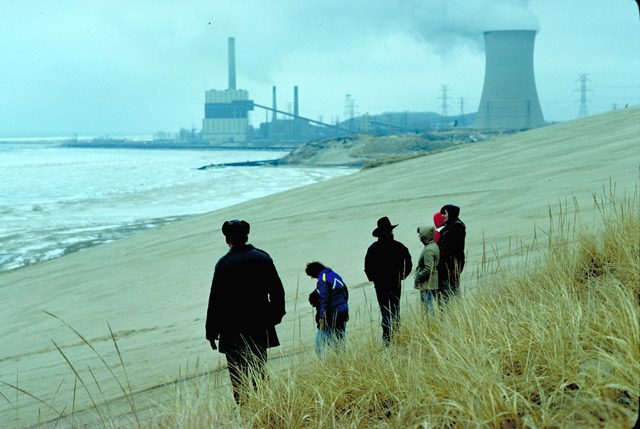
Lake Michigan dunes with a power plant in the background. (Photo courtesy of EPA)
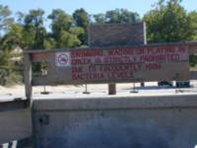
In some places, creeks wash bacteria into the lakes on or very near swimming beaches, making contracting E. coli a greater threat. (Photo by Lester Graham)
A sewage treatment plant in Chicago, Illinois. (Photo courtesy of
EPA)
If you swim or play on the beaches around the Great Lakes, you’ve
probably heard about ‘beach closings.’ At best, the situation is an inconvenience.
At worst, it’s a serious health risk for some people. That’s because the
beaches are closed due to dangerous levels of bacteria in the water.
Beach closures are not all that new, but Shawn Allee reports… the
science behind them could change dramatically in the next few years:
Transcript
We’re continuing our series, Ten Threats to the Great Lakes. Our field guide through the series is Lester Graham. He says anyone who visits Great Lakes beach is familiar with one of the Ten Threats.
If you swim or play on the beaches around the Great Lakes, you’ve
probably heard about ‘beach closings.’ At best, the situation is an inconvenience.
At worst, it’s a serious health risk for some people. That’s because the
beaches are closed due to dangerous levels of bacteria in the water.
Beach closures are not all that new, but Shawn Allee reports… the
science behind them could change dramatically in the next few years:
(Sound of dog and beach)
During the summer, dogs and their owners usually play together in the
water along this Lake Michigan beach, but today, several dog owners
scowl from the sand while their dogs splash around.
“It’s e coli day … it’s a hardship.”
This beachgoer’s upset, and like she said, e coli’s to blame.
Park officials tested the water the previous day and found high levels of
the bacterium. Missing a little fun on the beach doesn’t sound like a big
deal, but there’s more at stake than recreation.
Cameron Davis is with the Alliance for the Great Lakes, a regional
advocacy group.
“Beaches are most peoples biggest, tightest connection to the Great
Lakes, so when beaches close, they really impact our quality of life in the
region.”
And ultimately, health is at stake too. For a long time, scientists tested
beach water for e coli because it’s associated with human feces. That is,
if e coli’s in the water, there’s a good chance sewage is there too, and
sewage can carry dangerous organisms – stuff that can cause hepatitis,
gastric diseases, and rashes.
Sewage can get into the Great Lakes after heavy rains. That’s because
some sewers and drains can’t keep up with the flow, and waste heads to
the lakes.
For a long time, scientists thought human feces was the only source of e
coli in Great Lakes water, but a puzzling phenomenon has them looking
for other causes, too. Experts say cities have been dumping less sewage
into the Great Lakes in recent years, but we’re seeing more e coli and
more beach closings.
Paul Bertram is a scientist with the U.S. Environmental Protection
Agency. He says, we’re closing more beaches because we’re testing
them more often.
“But I don’t think it’s because the Great Lakes are getting more polluted,
and more filled with pathogens, I think we’re just looking for it more.”
If we’re finding more e coli because we’re testing more often, we still
have a problem. We still need to know where the e coli’s coming from.
Bertram says there might be another culprit besides sewage.
“There is some evidence that it may in fact be coming from birds, flocks
of seagulls, things like that.”
But some researchers doubt sewage and bird droppings can account for
high e coli levels.
(Sound of research team)
A few researchers are sorting vials of water in a lab at the Lake Michigan
Ecological Research Station in Indiana.
Richard Whitman leads this research team. He says, in the past,
scientists could predict beach closings by looking out for certain events.
For example, they would take note of sewer overflows after heavy rains.
Whitman says researchers can’t rely on those triggers anymore.
“A large number, maybe even a majority of closures remain unexplained.
Today, we have closures and there’s no rainfall, may not even be
gulls, and we don’t know why the bacteria levels are high.”
Whitman has a hunch that e coli can grow in the wild, and doesn’t
always need human feces to thrive.
“This is my theory. E coli was here before we were. It has an ecology of
its own that we need understand and recognize.”
The idea’s pretty controversial. It runs against the prevailing theory that
e coli only grows in waste from warm-blooded animals, such as human
beings and gulls, but the idea’s also a kind of political bombshell.
If he’s right, it would mean our tests for e coli aren’t very accurate – they
don’t tell us whether there’s sewage around. After all, if e coli is nearly
everywhere, how can we assume it’s a sign of sewage?
“As a pollution indicator, you don’t want it to multiply. If it’s got an
ecology of its own, multiplying on its own, doing its own thing, then it’s
not a very good indicator.”
Whitman wants us to try other kinds of tests to find sewage. One idea is
to look for caffeine in the water. Caffeine’s definitely in sewage but it’s
not found naturally in the Great Lakes, but until we change our water
tests, Whitman will continue his work. He says we still need to know
how much e coli’s in nature and how much is there because of us.
Environmentalists want the government to keep a close watch on the new
science. They say we can’t let questions about the relationship between
e coli and sewage stop our effort to keep sewage and other waste out of
the Great Lakes.
An investigation has found that the Air Force used the
Apostle Islands and Lake Superior for bombing practice in the early 1970’s. The Great Lakes Radio Consortium’s Mike Simonson has the story:
Transcript
An investigation has found that the Air Force used the Apostle Islands and Lake
Superior for bombing practice in the early 1970’s. The Great Lakes Radio
Consortium’s Mike Simonson has the story:
Jim Erickson was hoping to pull in a net full of fish one afternoon thirty years
ago, but his catch had a surprise. The Bayfield, Wisconsin fisherman had
snagged a missile.
“It was about four feet long and had some fins on it. They used to run those runs
outside of Outer Island there during the summer. Target practice, I guess.”
Erickson strapped the missile to the top of his fishing boat and tooled back to
Bayfield, where he handed it over to the Coast Guard. Erickson says he’s not
sure if the missile was a dummy or had live ammo. That’s one missile of three he
knows of that local fisherman pulled in around the Apostle Islands.
An investigation by the nearby Red Cliff tribe uncovered Erickson’s story. The
U.S. Department of Defense paid for that investigation. It is uncovering evidence
of different uses by the military of Lake Superior, including dumping tons of
ammunition after World War II.
Political pressure is building for elected officials to do
something to stop shipments of trash from Canada. But as the Great
Lakes Radio Consortium’s Rick Pluta reports, there’s no evidence to
suggest Canadian trash haulers will be stopped at the border anytime
soon:
Transcript
Political pressure is building for elected officials to do something to stop
shipments of trash from Canada. But as the Great Lakes Radio Consortium’s
Rick Pluta reports, there’s no evidence to suggest Canadian trash haulers
will be stopped at the border anytime soon:
The effort to ban Canadian trash shipments has always been complicated by
the fact that waste headed to landfills is considered a commodity. And – on
the U.S. side of the border – international trafficking in commodities can
only be regulated by the federal government.
There is a bill in Congress to give states such as Michigan the authority to
regulate waste-hauling. And a bill in the Michigan Legislature would ban the
shipments from Canada 90 days after a federal law is enacted.
But there’s a question on whether Congress can hand a federal responsibility
over to the state of Michigan. And there’s a question on whether the state
of Michigan can legally cancel Canada’s contracts with private landfills.
Another possibility is simply increasing dumping fees. But that would place
an added burden on Michigan taxpayers who would also have to pay more to
have their trash hauled away.
Pull out a map and you’ll find the Great Lakes area holds resources that no other place can claim. The region is rich in lakes and forests and scenic views. But a road map just covers the surface. We know much less about what’s under the earth. Now, a team of geologists is working to map the resources under the ground. The Great Lakes Radio Consortium’s Erin Toner reports:
Transcript
Pull out a map and you’ll find the Great Lakes area holds resources that no other
place can claim.
The region is rich in lakes and forests and scenic views. But a road map just
covers the surface.
We know much less about what’s under the earth. Now, a team of geologists from the
Great
Lakes states is working to map the resources under the ground. The Great Lakes Radio
Consortium’s Erin Toner reports:
Look outside – look out your car window or into your backyard and try to erase
everything you
see. Take away the playgrounds and the concrete parking lots. Strip away the trees
and the grass
and the topsoil in your garden.
This is the way Kevin Kincare imagines the world. A picture of nothing except naked
landforms
– massive hills and cavernous valleys. All created by gigantic pieces of ice that
gouged and
ground their way down the globe from Canada. This would be the picture of Great
Lakes states
about 15-thousand years ago. It’s the picture Kincare is slowly putting down on paper.
“This is a big chunk of granite and you can see this one side is flat and looks
polished. The
glacier was moving across. There’s grooves right here. So this is the direction
the ice was
moving.”
Kincare is a glacial geologist with the Michigan Department of Environmental
Quality. Six years
ago, he helped start the Central Great Lakes Geologic Mapping Coalition. It’s a
group of
geologists from four states – Michigan, Indiana, Illinois and Ohio – and the U.S.
Geological
Survey. They’re working to put together a 3-D digital map of the region’s glacial
geology.
They’ll map everything down to the bedrock, which can be hundreds of feet below the
Earth’s
surface.
The first step in geologic mapping is compiling information from local maps. After
that it’s out
to the field.
At Tacy Brother’s Gravel Pit, a massive machine is sorting big scoops of earth into
piles of sand,
gravel and rocks.
Kincare is now working on mapping a small county on Lake Michigan. He says looking
at a
gravel pit is like looking at nature’s record of thousands of years of changes to
the planet’s
surface.
“That starts to pull the whole story together. How the ice retreated across the
county from east to
west and where all the rivers that were carrying the melting glacier ice and
depositing thick
sections of sand, and where the glacial lakes were, where all the silt and clay was
dropping out.”
Geologists say one of the most important uses for the maps is locating water
resources.
Nationally, Michigan ranks first in the number of people who use household wells to
get their
drinking water. Illinois, Ohio and Indiana rank among the top 15 in the nation for
household
water well use.
Gary Witkowski’s job is to protect the environment in his county in southwest
Michigan. He says
the first step in protecting groundwater is knowing exactly where it is.
“It’d be a tremendous help for us if we could just go to a resource like this and
pull that
information. Not only to us, but, I mean, even to the developer, it would be a
major plus that they
could look at.”
Knowing exactly what’s under the ground also helps planners build in the right
places. And it
helps them avoid building in the wrong places. For example, planners can put
neighborhoods
close to supplies of groundwater. They can discourage development on land rich in
minerals and
construction materials, such as sand and gravel. And they can make sure they don’t
build
industrial plants in places that are especially vulnerable to pollution.
Dennis O’Leary is with the U.S. Geological Survey. He’s helping Kevin Kincare with
the map.
“Those kinds of decisions that involve competing interests really can’t be made
rationally unless
there’s a body of knowledge, of fact, that relates to just what the question’s all
about and that’s
what these maps provide.”
But it could be awhile before people have access to maps this detailed. The four
states in the
mapping coalition and the Geological Survey all have to share 500-thousand dollars a
year for the
project. That means Kevin Kincare can map only one county every three years. It
would take
two centuries just to finish his state.
“We’d have to have a lot of medical breakthroughs for me to finish this project.”
Kincare says the maps are too important to wait that long. He says they need
20-million-dollars a
year from Congress. With that money, they could put together a complete geologic
map of the
Great Lakes region in about 16 years. Kincare says he’s not optimistic they’ll get
that kind of
money.
For the Great Lakes Radio Consortium, I’m Erin Toner.