Some scientists blame global warming for larger and more intense hurricanes.
(Photo courtesy of NASA)
When it comes to hurricanes,
apparently size does matter.
New research suggests the bigger
the storm, the more tornadoes it
spawns. Tanya Ott reports:
Transcript
When it comes to hurricanes,
apparently size does matter.
New research suggests the bigger
the storm, the more tornadoes it
spawns. Tanya Ott reports:
Last year, Hurricane Ike ripped through Texas and the Midwest. It was a
relatively weak Category 2 storm. But it spun off a lot of tornadoes and
caused 32 billion dollars in damage.
Researchers at the Georgia Institute of
Technology say they have a new model for predicting how many tornadoes a
hurricane will cause. Dr. Judith Curry says storm size – not intensity –
is the key.
“A lot of time people just think, oh it’s Category 5 or
it’s a Category 2, and they immediately calculate the risk to damage in
their head and the 5 is bad ande 2 isn’t so bad.”
But, Curry says, sometimes a 5 can be small and tight, and a 2,
especially one like Ike, can be big and produce a lot of tornadoes.
The study is published in this month’s Geophysical Research Letters.
Some scientists blame global warming for larger and more intense hurricanes.
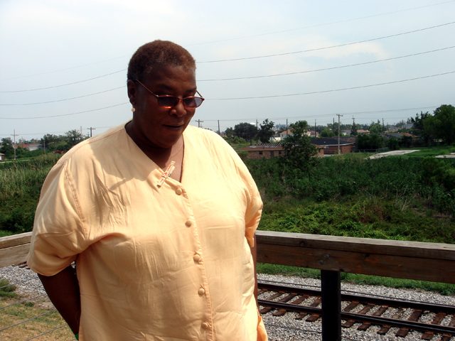
Pam Dashiell is with the Lower 9th Ward Center for Sustainable Engagement and Development. The Lower 9th Ward is in the background. (Photo by Samara Freemark)
There are various green houses and developments in the 9th being constructed by several different groups - including GoGreen and the Make it Right Foundation. Note the solar panels, raised houses, and odd roof lines. (Photo by Samara Freemark)
Four years ago, Hurricane Katrina
hit New Orleans. The city still
hasn’t figured out how to protect
itself. Most of the conversation
focuses on rebuilding the city’s
levees. But some people in New
Orleans are starting to think beyond
levees. They call their strategy
resilience planning. And they think
New Orleans can become America’s
leader in it. Samara Freemark reports:
Transcript
Four years ago, Hurricane Katrina
hit New Orleans. The city still
hasn’t figured out how to protect
itself. Most of the conversation
focuses on rebuilding the city’s
levees. But some people in New
Orleans are starting to think beyond
levees. They call their strategy
resilience planning. And they think
New Orleans can become America’s
leader in it. Samara Freemark reports:
When Pam Dashiell moved back to New Orleans after Hurricane Katrina, she couldn’t believe what people were saying about her neighborhood.
“People were saying, well, the 9th Ward should be a drainage ditch. There’s no way it can possibly come back.”
Dashiell is the co-director of the Lower 9th Ward Center for Sustainable Engagement and Development. And after the storm, she became one of the leaders demanding the city be built back exactly as it had been before. New houses put up wherever old ones had been knocked down. Social services restored to all neighborhoods. And most importantly, levees. Levees big enough and strong enough to protect the city from anything a hurricane could throw at it.
“That was the fundamental argument and discussion back then. That was the battle.”
But Dashiell’s thinking has changed over the past couple of years. The levees that were promised after Katrina still haven’t been completed. Dashiell says eventually she gave up on them and started looking for other solutions.
“You’ve got to move. You’ve got to go forward. At this point we are not protected. So we gotta act like that and deal accordingly.”
“Levees and stuff like that are great, but they’re not going to be the salvation of this area.”
That’s Marco Cocito-Manoc. He’s with the Greater New Orleans Foundation. They’re one of the groups involved in rebuilding the city.
“We can’t just lobby for bigger walls, higher walls. The truth is that New Orleans can never be sufficiently protected from flooding. So everyone has to adopt what in this area is a brand new mindset.”
Cocito-Manoc calls that new mindset “resilience planning”. That’s making small, local changes to help the city manage flood water, rather than trying to hold it back at all costs.
It’s a strategy that’s being implemented in the Lower 9th Ward by Pam Dashiell’s group and others. A lot of these groups have moved away from pushing for more levees. Instead, they’re building raised houses on higher ground, and making sure they’re properly weatherized. They’re perfecting evacuation plans, so when evacuations do happen, they’re quick and orderly. And they’re installing permeable surfaces and rain gardens to reduce surface water. These kinds of changes won’t prevent flooding, but they’ll limit the devastation that sometimes goes along with it.
Cocito-Manoc says measures like these could actually set an example for other cities that will face rising sea levels in the next century. Think New York, or Miami, or Boston.
“I know that it’s difficult to see New Orleans as leading in much. But I think this is really our opportunity to become a global center for learning how to cope with water, and use water as an asset rather than as something that threatens our existence.”
As for Pam Dashiell, her focus right now is on the Lower 9th Ward. I asked her how she imagined the future of her neighborhood.
“I would see rain gardens. Strong green infrastructure. I see a new sewer system. I see the lower 9th ward recognized as a community that helped lead the way to a more sustainable future. (Laughs) I got good dreams.”
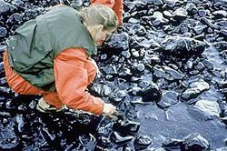
A NOAA scientist surveying an oiled beach to assess the depth of oil
penetration soon after the spill (Photo courtesy of NOAA)
Twenty years ago this week, an oil tanker ran aground on a rocky reef in Alaska’s Prince William Sound. The Exxon Valdez spilled more than 11 million gallons of crude oil. It’s considered to be perhaps the biggest ecological disaster in US history. Ann Dornfeld has this look at how oil spill prevention and preparedness have changed in the two decades since Valdez:
Transcript
Twenty years ago this week, an oil tanker ran aground on a rocky reef in Alaska’s Prince William Sound. The Exxon Valdez spilled more than 11 million gallons of crude oil. It’s considered to be perhaps the biggest ecological disaster in US history. Ann Dornfeld has this look at how oil spill prevention and preparedness have changed in the two decades since Valdez:
The call came in just after midnight.
“Ah, evidently leaking some oil and we’re gonna be here for a while.”
Court records indicate Captain Joseph Hazelwood was likely drunk when the Exxon Valdez ran aground.
There was hardly any clean-up equipment on hand. No plan for action. The location was remote.
Oil polluted a stretch of Alaskan coastline the length of the entire west coast of the U.S. The oil killed fish, sea otters, harbor seals and an estimated quarter of a million birds. Today, there is still oil on some beaches.
Twenty years later, a cargo vessel has just reported a spill of 160
gallons of oil in Washington state’s Commencement Bay. Investigators
have filled the “Spill Situation Room” in the state Department of Ecology.
“Who’s responsible for actually maintaining
the bow thruster, when was the last time they performed maintenance on it?”
“You mean one of the staff on board?”
“Yeah.”
Spill Response Manager David Byers says coastal states learned a lesson from Exxon Valdez, and developed rapid response systems like this.
“We’ve got crews headed up in a helicopter to do on-
water observations, we’ve got response resources on the water headed out to do containment when we find the location of the oil.”
Byers says the state handles dozens of spills this size each year, making it somewhat of a well-oiled machine.
After the Exxon Valdez, the state of Washington put in place some tough prevention standards. But the U.S. Supreme Court ruled against the state.
The court ruled the state was making safety demands of oil companies that only the federal government could make.
Mike Cooper is Chairman of the state’s Oil Spills Advisory Council. He says that ruling is one reason why small oil spills are common in Washington’s bays. He says other states have come up against the same restrictions.
“When the Massachusetts legislature passed strict laws,
the United States Coast Guard and the industry did the same thing that they did to the people of Washington state. They sued the people of the state of Massachusetts and said, ‘We’ll decide if industry has to pay.'”
The federal Oil Pollution Act did raise industry’s liability and the amount of federal money available in the event of a spill. It also requires oil tankers and barges in U.S. waters to be double-hulled by 2015. The Exxon Valdez’ single hull was easily gouged open when it ran aground.
Today, most U.S.-flagged tankers and barges are double-hulled. Most foreign tankers aren’t yet.
But there’s no law requiring a second hull on cargo ships. Bruce Wishart is Policy Director for People for Puget Sound. He says it’s cargo vessels that are most likely to spill oil.
“It’s commonly assumed that oil tankers pose the
single greatest threat in terms of an oil spill. There are actually many, many more cargo vessels plying our waters that pose a very significant risk simply because they carry a lot of fuel on board.”
In 2007, the cargo vessel Cosco Busan spilled 53,000 gallons of oil into San Francisco Bay. Thousands of birds died, including endangered species. A fully-loaded cargo ship can contain 40 times more oil than what leaked from the Cosco Busan.
So, while oil tankers have become safer in the two decades since the Exxon Valdez, the nation’s waterways still remain at risk of a major spill.
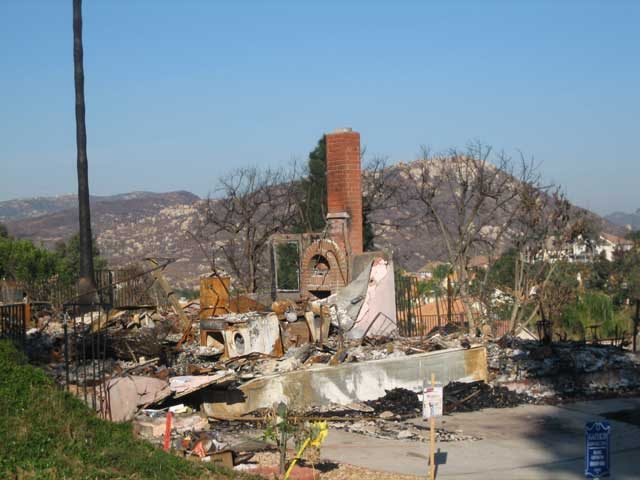
In San Diego’s suburbs, the homes on the outer edges of developments and in close proximity to the surrounding countryside are the first to burn. (Photo by Lisa Ann Pinkerton)
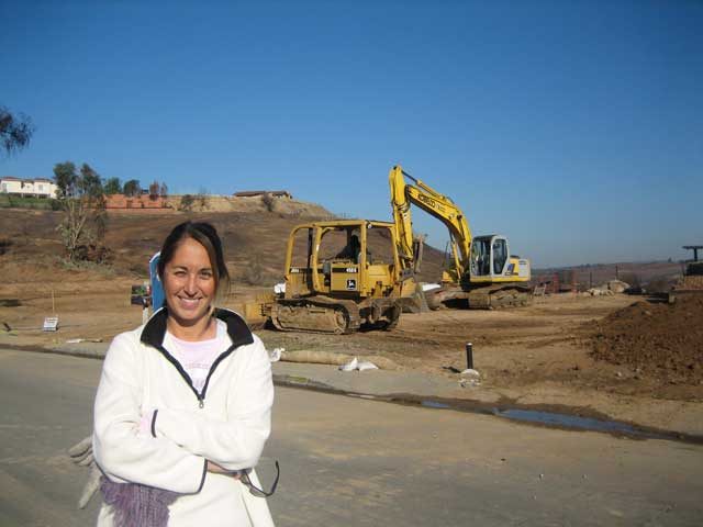
Shannon Denton says even though dozens of homes were lost in her neighborhood, the natural amenities it offers outweighs her home’s risk of fire. (Photo by Lisa Ann Pinkerton)
In San Diego, fire can float from house to house on the wind. The more current a homes building codes, the greater chance of its survival. (Photo by Lisa Ann Pinkerton)
Most wildfires across the nation begin in wilderness areas and spread to urban development, but man’s presence usually brings the spark, typically in the form of a downed power line. (Photo by Lisa Ann Pinkerton)
More and more Americans are building homes closer to wilderness. Natural surroundings offer amenities like hiking trails, within walking distance of front doors. But living closer to nature increases the risk of a natural disaster, for both man and the wilderness. (Photo by Lisa Ann Pinkerton)
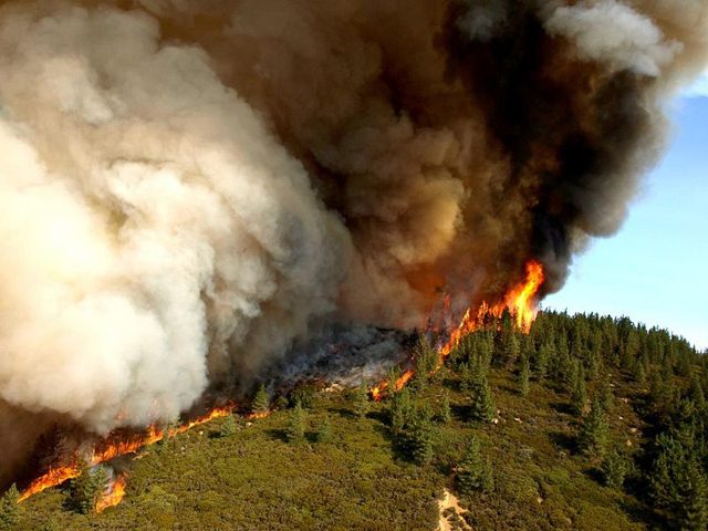
Active flame front of the Zaca Fire, the second largest fire on record in California. (U.S. Forest Service photo by John Newman)
During the past 20 years, we’ve been building
homes closer to nature. Whether it’s near coastal areas
or in the wilderness, homebuyers want to live in more
natural settings. But… Lisa Ann Pinkerton reports
often that means putting people and property in the path
of floods or fire:
Transcript
During the past 20 years, we’ve been building
homes closer to nature. Whether it’s near coastal areas
or in the wilderness, homebuyers want to live in more
natural settings. But… Lisa Ann Pinkerton reports
often that means putting people and property in the path
of floods or fire:
2007 was the second worst in history for wildfires in the U.S. Nine-million acres were
scorched and Southern California bore the brunt of it. Most of the property damage was
in San Diego where wildfires in wilderness areas spread to suburban neighborhoods. Half a
million people were evacuated and Shannon Denton was among them. She says her
neighborhood was cleared out at 4 in the morning.
“We were scared. ‘Cause we didn’t – luckily we had all our pictures organized, so we just took most of our pictures and our video stuff, grabbed our kids at the last minute and left within a half-hour. It was scary, very
scary.”
(construction sound)
These days, Denton’s subdivision is busy. There are bulldozers demolishing the burned
out remains of old houses. And construction crews are building new ones on every single
street.
Denton’s thankful her house was spared. But she says even if it had burned down, she’d
take the risk of it happening again, because she likes living here.
“It’s pretty close to nature. There’s a lot of walking and hiking, a lot of mountains that you can take trails and different things.”
Despite the risk of fire, people like Denton don’t want to leave. Some of the 18-
thousand homes lost in San Diego last fall were built in places where wildfires had
burned only four years earlier.
That’s not unusual. The US Fire Administration says nearly 40% of new home
development across the country is in places where residential homes and wilderness meet,
and thus, are more prone to fire.
“They have a right to build that single family home.”
That’s Jeff Murphy of San Diego County’s Department of Planning.
“As a jurisdiction its our responsibility to have codes and ordinances that are
in place to make sure that there’s minimal structural damage as the result of wildfire and minimize
the risk of loss of life.”
Murphy says people are going to live where they want to, all government can do is
require smart development. And San Diego’s building codes are the most restrictive in
the California. They were reevaluated after the 2003 wildfires, when seven percent of the
homes were destroyed.
In the 2007 wildfires, Murphy says the new codes reduced that loss to one-percent.
“Even though we had a lot of structure loss during these fires, what these
numbers are showing us is that our codes are working.”
And Americans aren’t just building in areas at risk of fire. We build in flood zones, too.
FEMA estimates around 10 million people in the US are at risk of flooding. And
according to the United Nations, we saw the most floods of any country last year.
Roger Kennedy is a former director of the National Park Service. He says this kind of
“risky living” costs US taxpayers about two-billion dollars a year in firefighting and
rebuilding costs. The total in property damage hovers around 20 Billion.
Kennedy says people are choosing to build and live on land that’s in danger-prone areas
because they’re not responsible for the true costs. Insurance, guaranteed mortgages, and
federal disaster relief have reduced the personal financial risk.
“People wouldn’t settle in places from which they knew they would not be
rescued and where the taxpayers wouldn’t pick up- or the insurance company which is
essentially the same thing- wouldn’t pick up the tab.”
Kennedy says knowing about a home’s potential risk might reduce the material cost of
fires and floods. And, it might save lives.
But he says, people have to want to know their risks. And even then… they might choose
to ignore it. Because for many, the enjoyment their property brings far outweighs the
occasional “Act of Nature.”
For the Environment Report, I’m Lisa Ann Pinkerton.
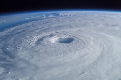 Some scientists blame global warming for larger and more intense hurricanes. (Photo courtesy of NASA)